Ghodadongari tehsil
Ghodadongari | |
|---|---|
Tehsil | |
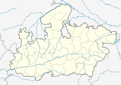
 Ghodadongari Location in Madhya Pradesh Show map of Madhya Pradesh  Ghodadongari Ghodadongari (India) Show map of India | |
| Coordinates: 22°07′26″N 77°59′58″E / 22.124017°N 77.999559°E / 22.124017; 77.999559Coordinates: 22°07′26″N 77°59′58″E / 22.124017°N 77.999559°E / 22.124017; 77.999559 | |
| Country | |
| State | Madhya Pradesh |
| District | Betul district |
| Government | |
| • Type | Janpad Panchayat |
| • Body | Council |
| Area | |
| • Total | 758.49 km2 (292.85 sq mi) |
| Population (2011) | |
| • Total | 235,790 |
| Languages | |
| • Official | Hindi |
| Time zone | UTC+5:30 (IST) |
| Postal code (PIN) | 460443 |
| Area code(s) | 07146 |
| ISO 3166 code | MP-IN |
| Vehicle registration | MP 48 |
| No. of Villages | 172 |
| Sex ratio | 968 |
Ghodadongari tehsil is a fourth-order administrative and revenue division, a subdivision of third-order administrative and revenue division of Betul district of Madhya Pradesh.[1][2]
Geography
Ghodadongari tehsil has an area of 758.49 sq kilometers. It is bounded by Shahpur tehsil in the west and northwest, Hoshangabad district in the north, Chhindwara district in the northeast and east, Amla tehsil in the southeast, Betul tehsil in the south and Chicholi tehsil in the southwest.
See also
- Betul district
References
^ New Delhi, The Office of the Registrar General and Census Commissioner, India (2011). "District Census Handbook of Betul, village and town directory" (PDF). p. 34,37. Archived from the original (PDF) on 9 February 2017. Retrieved 9 February 2017..mw-parser-output cite.citationfont-style:inherit.mw-parser-output .citation qquotes:"""""""'""'".mw-parser-output .citation .cs1-lock-free abackground:url("//upload.wikimedia.org/wikipedia/commons/thumb/6/65/Lock-green.svg/9px-Lock-green.svg.png")no-repeat;background-position:right .1em center.mw-parser-output .citation .cs1-lock-limited a,.mw-parser-output .citation .cs1-lock-registration abackground:url("//upload.wikimedia.org/wikipedia/commons/thumb/d/d6/Lock-gray-alt-2.svg/9px-Lock-gray-alt-2.svg.png")no-repeat;background-position:right .1em center.mw-parser-output .citation .cs1-lock-subscription abackground:url("//upload.wikimedia.org/wikipedia/commons/thumb/a/aa/Lock-red-alt-2.svg/9px-Lock-red-alt-2.svg.png")no-repeat;background-position:right .1em center.mw-parser-output .cs1-subscription,.mw-parser-output .cs1-registrationcolor:#555.mw-parser-output .cs1-subscription span,.mw-parser-output .cs1-registration spanborder-bottom:1px dotted;cursor:help.mw-parser-output .cs1-ws-icon abackground:url("//upload.wikimedia.org/wikipedia/commons/thumb/4/4c/Wikisource-logo.svg/12px-Wikisource-logo.svg.png")no-repeat;background-position:right .1em center.mw-parser-output code.cs1-codecolor:inherit;background:inherit;border:inherit;padding:inherit.mw-parser-output .cs1-hidden-errordisplay:none;font-size:100%.mw-parser-output .cs1-visible-errorfont-size:100%.mw-parser-output .cs1-maintdisplay:none;color:#33aa33;margin-left:0.3em.mw-parser-output .cs1-subscription,.mw-parser-output .cs1-registration,.mw-parser-output .cs1-formatfont-size:95%.mw-parser-output .cs1-kern-left,.mw-parser-output .cs1-kern-wl-leftpadding-left:0.2em.mw-parser-output .cs1-kern-right,.mw-parser-output .cs1-kern-wl-rightpadding-right:0.2em
^ New Delhi, The Office of the Registrar General and Census Commissioner, India (2011). "District Census Handbook of Betul, village and townwise primary census abstract (PCA)" (PDF). p. 13,26. Archived from the original (PDF) on 9 February 2017. Retrieved 9 February 2017.
This article related to a location in Madhya Pradesh is a stub. You can help Wikipedia by expanding it. |
