Treaty of Greenville

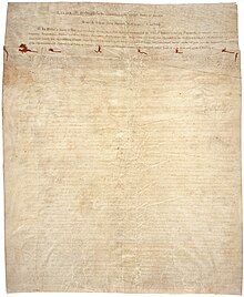
First page of the Treaty of Greenville.
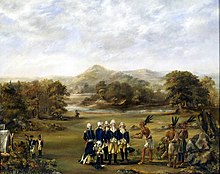
One of Anthony Wayne's officers may have painted the treaty negotiations, c. 1795.
The Treaty of Greenville formally titled Treaty with the Wyandots, etc., was a 1795 treaty between the United States and Indians of the Northwest Territory including the Wyandot and Delaware, which redefined the boundary between Indian lands and Whiteman's lands in the Northwest Territory.
It was signed at Fort Greenville,[1] now Greenville, Ohio on August 3, 1795, following the Native American loss at the Battle of Fallen Timbers a year earlier. It ended the Northwest Indian War in the Ohio Country, limited Indian Country to northwestern Ohio, and began the practice of annual payments following land concessions. The parties to the treaty were a coalition of Native American tribes known as the Western Confederacy, and the United States government represented by General Anthony Wayne and local frontiersmen.
The Treaty became synonymous with the end of the frontier in the Northwest Territory.
Contents
1 Participants
2 Terms of the Treaty
2.1 Land for annuity
2.2 Treaty line
2.3 Others parcels of land
2.4 Misc provisions
3 Aftermath
4 Depictions
5 See also
6 Gallery
7 Notes
8 References
9 External links
Participants
General "Mad Anthony" Wayne, who led the victory at Fallen Timbers, led the American delegation. Other members included William Wells, William Henry Harrison, William Clark, Caleb Swan, and Meriwether Lewis.
Native American leaders who signed the treaty included leaders of these bands and tribes: Wyandot (chiefs Tarhe, Leatherlips, and Roundhead), Delaware (several bands). Shawnee (Chief Blue Jacket), Ottawa (several bands), Chippewa, Potawatomi (23 signatories, including Gomo, Siggenauk, Black Partridge, Topinabee and Five Medals), Miami (several bands, including Chief Little Turtle of the Miami-Illinois band), Wea, Kickapoo, and Kaskaskia.
Terms of the Treaty
The Treaty consisted of 10 articles that provided:
Land for annuity
The treaty established what became known as the Greenville Treaty Line delineated below. For several years it distinguished Native American territory from lands open to European-American settlers, although settlers continued to encroach. In exchange for goods to the value of $20,000 (such as blankets, utensils, and domestic animals), the Native American tribes ceded to the United States large parts of modern-day Ohio.
The treaty also established the "annuity" system of payment in return for Native American cessions of land east of the treaty line: yearly grants of federal money and supplies of calico cloth to Native American tribes. This institutionalized continuing government influence in tribal affairs and gave outsiders considerable control over Native American life.[2][better source needed]
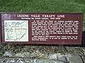
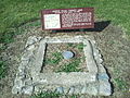
Treaty line

The Greenville Treaty line in Ohio and Indiana
The treaty redefined with slight modifications the boundaries in Ohio established previously by the Treaty of Fort McIntosh in 1785 and reasserted in the Treaty of Fort Harmar in 1789. In particular, the western boundary, which used to run northwesterly to the Maumee River, now ran southerly to the Ohio River.
Ohio had developed settlements and defined tracts of land prior to 1795, including the Western Reserve, Seven Ranges survey area, Virginia Military District, Symmes Purchase, and 2 Ohio Company purchases all in eastern and southern Ohio as well as the line of western forts built by Wayne through Fort Recovery along the Great Miami River Valley. The boundary line would need to encompass all these, covering about 2/3 of Ohio Country, within Whiteman's land.
The treaty line began at the mouth of the Cuyahoga River in present-day Cleveland and ran south along the river to the portage between the Cuyahoga and Tuscarawas rivers, in what is now known as the Portage Lakes area between Akron and Canton. The line continued down the Tuscarawas to Fort Laurens near present-day Bolivar. From there, the line ran west-southwest to near present-day Fort Loramie on a branch of the Great Miami River. From there, the line ran west-northwest to Fort Recovery, on the Wabash River near the present-day boundary between Ohio and Indiana. From Fort Recovery, the line ran south-southwest to the Ohio River at a point opposite the mouth of the Kentucky River in present-day Carrollton, Kentucky.
Others parcels of land
There were also other forts along the Great Lakes nominally under U.S. sovereignty but occupied by the British including Fort Miamis, and other outpost forts in Ohio and Indiana. In Indiana, there was the Vincennes Tract, Clark's Grant and the settlement at Ouiatenon to protect.
The treaty also permitted established U.S. Army posts and allocated strategic reserved tracts within the Indian Country to the north and west of the ceded lands, the most important of which was the future site of Fort Dearborn (later, downtown Chicago) on Lake Michigan,[nb 1][4] Other American lands within Indian Country included Fort Detroit, Ouiatenon, Fort Wayne,[5]Fort Miami,[6] and Fort Sandusky.[7]
The treaty exempted from relinquishment established settlements at Vincennes, Clark's Grant, various French settlements and Fort Massac.
Misc provisions
The United States renounced all claims to (Indian) lands not within the treaty line in Ohio or parcels exempted.
The Indians were to recognize the United States as the sole sovereign power in the entire Territory but otherwise the Indians would have free use of Indian lands as long as they were kindly disposed to Whitemen.
The treaty also arranged for an exchange of prisoners, and specified which parties would be responsible for enforcing the boundary and punishing transgressions.
Aftermath
Continuing encroachments by settlers on Indian Country north and west of the treaty line (and future treaty lines, see Treaty of Vincennes, Treaty of Grouseland, Treaty of Fort Wayne 1809), especially in Indiana would lead a disgruntled Tecumseh, who had not signed the Treaty of Greenville, to reform the Confederacy at Prophetstown, Indiana over the following decade. Unrest among the tribes culminated in the Battle of Tippecanoe in 1811, a major defeat for the Indians that may have contributed to the Indians siding with the British in the looming War of 1812.
The Treaty of Greenville closed the frontier in the Northwest Territory. Thereafter began a series of purchases of Indian lands by Treaty and Indian removals by law throughout the Territory (later Indiana Territory, etc., which became several modern states) interrupted briefly by the War of 1812. Indians were moved west of the Mississippi River to Indian Country reservations in what later became the state of Oklahoma in a process that culminated with the dismantling of the Great Miami Reserve in Indiana by Treaties in the 1830s. By 1840, the Old Northwest was essentially clear of Indians. Future Indian conflicts would all be west of the Mississippi.
The treaty line would become the southwestern boundary of the Northwest Territory at its division in 1800. Upon Ohio statehood in 1803, the western boundary of Ohio ran due north from a place on the Ohio River somewhat east of the south-southwesterly treaty line, leaving a sliver of land called "The Gore" in what is today southeastern Indiana remaining as part of the Northwest Territory. "The Gore" was ceded to Indiana Territory at that time, and became Dearborn County in March, 1803.
Among the signers were Meriwether Lewis and William Clark, who met for the first time here, and would go on to launch the Lewis and Clark expedition in 1804 to claim the Louisiana Purchase for the United States.
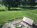
Historic Fort Greene Ville was abandoned in 1796; it would be another 12 years before the settlement of Greenville was founded on the site.
It was the last treaty signed by Gen. Wayne; he died just over a year later, in Dec. 1796.
Depictions
A painting commemorating the treaty hangs in the Ohio Statehouse. It was completed by Ohio artist Howard Chandler Christy. At 23 feet wide, it is the largest painting in the Ohio Statehouse.[8]
See also
- List of Indian treaties
Gallery

Notes
^ Six square miles centered at the mouth of the Chicago River. See Article 3 item 14 within the text of the treaty.[3]
References
^ for Nathanael Greene, a Major General in the Revolutionary War
^ Eric Foner, Give Me Liberty
^ Charles J. Kappler (1904). "TREATY WITH THE WYANDOT, ETC., 1795". U.S. Government treaties with American Indian tribes. Oklahoma State University Library. Retrieved 1 August 2009..mw-parser-output cite.citationfont-style:inherit.mw-parser-output qquotes:"""""""'""'".mw-parser-output code.cs1-codecolor:inherit;background:inherit;border:inherit;padding:inherit.mw-parser-output .cs1-lock-free abackground:url("//upload.wikimedia.org/wikipedia/commons/thumb/6/65/Lock-green.svg/9px-Lock-green.svg.png")no-repeat;background-position:right .1em center.mw-parser-output .cs1-lock-limited a,.mw-parser-output .cs1-lock-registration abackground:url("//upload.wikimedia.org/wikipedia/commons/thumb/d/d6/Lock-gray-alt-2.svg/9px-Lock-gray-alt-2.svg.png")no-repeat;background-position:right .1em center.mw-parser-output .cs1-lock-subscription abackground:url("//upload.wikimedia.org/wikipedia/commons/thumb/a/aa/Lock-red-alt-2.svg/9px-Lock-red-alt-2.svg.png")no-repeat;background-position:right .1em center.mw-parser-output .cs1-subscription,.mw-parser-output .cs1-registrationcolor:#555.mw-parser-output .cs1-subscription span,.mw-parser-output .cs1-registration spanborder-bottom:1px dotted;cursor:help.mw-parser-output .cs1-hidden-errordisplay:none;font-size:100%.mw-parser-output .cs1-visible-errorfont-size:100%.mw-parser-output .cs1-subscription,.mw-parser-output .cs1-registration,.mw-parser-output .cs1-formatfont-size:95%.mw-parser-output .cs1-kern-left,.mw-parser-output .cs1-kern-wl-leftpadding-left:0.2em.mw-parser-output .cs1-kern-right,.mw-parser-output .cs1-kern-wl-rightpadding-right:0.2em
^ "Fort Dearborn" in online Encyclopedia of Chicago accessed 2009-08-01
^ Ann Durkin Keating, Rising Up from Indian Country: the battle of Fort Dearborn and the Birth of Chicago (University of Chicago Press 2012) p. 40
ISBN 9780226428963
^ see Article 3 #8
^ see Article 3 #11
^ "Treaty of Greenville," Ohio Statehouse http://www.ohiostatehouse.org/galleries/media/capitol-ohio-the-treaty-of-greenville-art-walk-series-128488
External links
Wikisource has original text related to this article: Treaty of Greenville |
| Wikimedia Commons has media related to Treaty of Greenville. |
- Video explaining painting at the Ohio Statehouse
Coordinates: 40°06′28″N 84°37′54″W / 40.1078°N 84.6316°W / 40.1078; -84.6316


