Montana Highway 135
Montana Highway 135 | ||||
|---|---|---|---|---|
| Route information | ||||
| Maintained by MDT | ||||
| Length | 21.549 mi[1] (34.680 km) | |||
| Major junctions | ||||
| West end | ||||
| East end | ||||
| Location | ||||
| Counties | Mineral, Sanders | |||
| Highway system | ||||
| ||||

Montana Highway 135 (MT 135) is a 21.5-mile-long (34.6 km) state highway in western Montana. It begins at Interstate 90 (I-90) in St. Regis and ends at MT 200 near Paradise. The highway runs along the bank of the Clark Fork River and through Lolo National Forest.
Contents
1 Route description
2 Major intersections
3 See also
4 References
5 External links
Route description
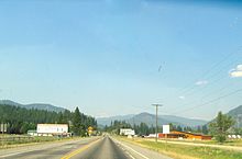
MT 135 as it exits St. Regis
MT 135 begins in St. Regis at exit 33 along I-90. Almost immediately, it comes to a four-way stop where it intersects the former U.S. Highway 10. From there, the highway heads to the north and northeast through Lolo National Forest and along the northern bank of the Clark Fork River. A line of the Montana Rail Link railroad runs parallel to the highway. Near its midpoint, MT 135 crosses the river and passes beneath the railroad; from there, the road and railroad run along opposite banks of the river. As the river winds, the highway follows closely; near Quinn, the river and road straighten. Just before the highway ends, it exits Lolo National Forest. The highway ends a couple miles east of Paradise at MT 200. Nearby is the mouth of the Clark Fork River, which empties into the Flathead River.[2]
Major intersections
| County | Location | mi[1] | km | Destinations | Notes |
|---|---|---|---|---|---|
| Mineral | St. Regis | 0.000 | 0.000 | Exit 33 on I-90 | |
| Sanders | Paradise | 21.549 | 34.680 | ||
| 1.000 mi = 1.609 km; 1.000 km = 0.621 mi | |||||
See also
 Montana portal
 U.S. Roads portal
References
^ ab Montana Department of Transportation (2013). "Montana Road Log" (PDF). Helena: Montana Department of Transportation. p. 176. Retrieved March 4, 2017..mw-parser-output cite.citationfont-style:inherit.mw-parser-output .citation qquotes:"""""""'""'".mw-parser-output .citation .cs1-lock-free abackground:url("//upload.wikimedia.org/wikipedia/commons/thumb/6/65/Lock-green.svg/9px-Lock-green.svg.png")no-repeat;background-position:right .1em center.mw-parser-output .citation .cs1-lock-limited a,.mw-parser-output .citation .cs1-lock-registration abackground:url("//upload.wikimedia.org/wikipedia/commons/thumb/d/d6/Lock-gray-alt-2.svg/9px-Lock-gray-alt-2.svg.png")no-repeat;background-position:right .1em center.mw-parser-output .citation .cs1-lock-subscription abackground:url("//upload.wikimedia.org/wikipedia/commons/thumb/a/aa/Lock-red-alt-2.svg/9px-Lock-red-alt-2.svg.png")no-repeat;background-position:right .1em center.mw-parser-output .cs1-subscription,.mw-parser-output .cs1-registrationcolor:#555.mw-parser-output .cs1-subscription span,.mw-parser-output .cs1-registration spanborder-bottom:1px dotted;cursor:help.mw-parser-output .cs1-ws-icon abackground:url("//upload.wikimedia.org/wikipedia/commons/thumb/4/4c/Wikisource-logo.svg/12px-Wikisource-logo.svg.png")no-repeat;background-position:right .1em center.mw-parser-output code.cs1-codecolor:inherit;background:inherit;border:inherit;padding:inherit.mw-parser-output .cs1-hidden-errordisplay:none;font-size:100%.mw-parser-output .cs1-visible-errorfont-size:100%.mw-parser-output .cs1-maintdisplay:none;color:#33aa33;margin-left:0.3em.mw-parser-output .cs1-subscription,.mw-parser-output .cs1-registration,.mw-parser-output .cs1-formatfont-size:95%.mw-parser-output .cs1-kern-left,.mw-parser-output .cs1-kern-wl-leftpadding-left:0.2em.mw-parser-output .cs1-kern-right,.mw-parser-output .cs1-kern-wl-rightpadding-right:0.2em
^ Google (March 4, 2017). "Montana Highway 135" (Map). Google Maps. Google. Retrieved March 4, 2017.
External links
| Wikimedia Commons has media related to Montana Highway 135. |
Hwy 135 / Clark Fork River - Montana on YouTube
Corcoran, David. "Montana Highway 135, MT-200 to I-90". Corco Highways.


