Beverley, South Australia
Beverley Adelaide, South Australia | |||||||||||||||
|---|---|---|---|---|---|---|---|---|---|---|---|---|---|---|---|
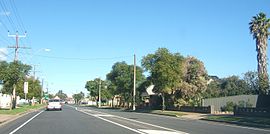 East Avenue, Beverley | |||||||||||||||
| Population |
| ||||||||||||||
| Established | 1849[3] | ||||||||||||||
| Postcode(s) | 5009[4] | ||||||||||||||
| Location | 6.1 km (4 mi) NW of Adelaide city centre[4] | ||||||||||||||
| LGA(s) | City of Charles Sturt[5] | ||||||||||||||
| State electorate(s) | Cheltenham | ||||||||||||||
| Federal Division(s) | Port Adelaide (2011)[6] | ||||||||||||||
| |||||||||||||||
Beverley is a western suburb of Adelaide, South Australia. It is located in the City of Charles Sturt.
Contents
1 Geography
2 History
3 Demographics
4 Politics
4.1 Local government
4.2 State and federal
5 Community
5.1 Schools
6 Facilities and attractions
6.1 Adelaide Arena
7 Transportation
7.1 Roads
7.2 Public transport
8 See also
9 References
10 External links
Geography
The suburb is mainly bounded by Port Road, East Avenue, Ledger Road and Grange Road.[7]
History
Beverley incorporates the formerly separate suburb of York,[8] site of the skin and fertiliser works of Crompton and Sons.[9] Other once important manufacturing businesses of the area were Pope Products Ltd. on Princess Street, Adelaide Potteries Ltd. on Toogood Avenue and a number of independent brickworks.
Beverley Post Office was open from 1 January 1881 until 1901.[10]
Demographics
The 2006 Census by the Australian Bureau of Statistics counted 1,362 persons in Beverley on census night. Of these, 51.6% were male and 48.4% were female.[2]
The majority of residents (67.1%) are of Australian birth, with other common census responses being England (2.5%), Greece (2.3%) and Italy (2.1%).[2]
The age distribution of Beverley residents is similar to that of the greater Australian population. 68.3% of residents were over 25 years in 2006, compared to the Australian average of 66.5%; and 31.7% were younger than 25 years, compared to the Australian average of 33.5%.[2]
Politics
Local government
Beverley is part of Beverley Ward in the City of Charles Sturt local government area, being represented in that council by Edgar Agius and Mick Harley.[5]
State and federal
Beverley lies in the state electoral district of Cheltenham,[11] but prior to the 2016 redistribution was in the Croydon district. Beverley is in the federal electoral division of Port Adelaide.[6] The suburb is represented in the South Australian House of Assembly by Michael Atkinson[11] and federally by Mark Butler.[6]
Community
Schools
St Michael's College is located on East Avenue.[12]
Facilities and attractions
Adelaide Arena
Adelaide Arena, located between William Street and Toogood Avenue, is an indoor basketball stadium and function centre.[13] Also known as Distinctive Homes Dome and, formerly, Clipsal Powerhouse, the facility was constructed in 1991, replacing the former Apollo Stadium. It is the home of the Adelaide 36ers and the Adelaide Lightning.[13]
Transportation
Roads
Beverley is serviced by Port Road, connecting the suburb to Port Adelaide and Adelaide city centre, and Grange Road, which forms part of its southern boundary. East Avenue, on Beverley's eastern boundary, links Port and Grange roads.[7]
Public transport
Beverley is serviced by public transport run by the Adelaide Metro.[14]
See also
| Wikimedia Commons has media related to Beverley, South Australia. |
- List of Adelaide suburbs
References
^ Australian Bureau of Statistics (31 October 2012). "Beverley (State Suburb)". 2011 Census QuickStats. Retrieved 14 February 2015..mw-parser-output cite.citationfont-style:inherit.mw-parser-output .citation qquotes:"""""""'""'".mw-parser-output .citation .cs1-lock-free abackground:url("//upload.wikimedia.org/wikipedia/commons/thumb/6/65/Lock-green.svg/9px-Lock-green.svg.png")no-repeat;background-position:right .1em center.mw-parser-output .citation .cs1-lock-limited a,.mw-parser-output .citation .cs1-lock-registration abackground:url("//upload.wikimedia.org/wikipedia/commons/thumb/d/d6/Lock-gray-alt-2.svg/9px-Lock-gray-alt-2.svg.png")no-repeat;background-position:right .1em center.mw-parser-output .citation .cs1-lock-subscription abackground:url("//upload.wikimedia.org/wikipedia/commons/thumb/a/aa/Lock-red-alt-2.svg/9px-Lock-red-alt-2.svg.png")no-repeat;background-position:right .1em center.mw-parser-output .cs1-subscription,.mw-parser-output .cs1-registrationcolor:#555.mw-parser-output .cs1-subscription span,.mw-parser-output .cs1-registration spanborder-bottom:1px dotted;cursor:help.mw-parser-output .cs1-ws-icon abackground:url("//upload.wikimedia.org/wikipedia/commons/thumb/4/4c/Wikisource-logo.svg/12px-Wikisource-logo.svg.png")no-repeat;background-position:right .1em center.mw-parser-output code.cs1-codecolor:inherit;background:inherit;border:inherit;padding:inherit.mw-parser-output .cs1-hidden-errordisplay:none;font-size:100%.mw-parser-output .cs1-visible-errorfont-size:100%.mw-parser-output .cs1-maintdisplay:none;color:#33aa33;margin-left:0.3em.mw-parser-output .cs1-subscription,.mw-parser-output .cs1-registration,.mw-parser-output .cs1-formatfont-size:95%.mw-parser-output .cs1-kern-left,.mw-parser-output .cs1-kern-wl-leftpadding-left:0.2em.mw-parser-output .cs1-kern-right,.mw-parser-output .cs1-kern-wl-rightpadding-right:0.2em
^ abcd Australian Bureau of Statistics (25 October 2007). "Beverley (State Suburb)". 2006 Census QuickStats. Retrieved 2 June 2011.
^ "Place Names of South Australia". The Manning Index of South Australian History. State Library of South Australia. Retrieved 2 June 2011.
^ ab "Beverley, South Australia (Adelaide)". Postcodes-Australia. Postcodes-Australia.com. Retrieved 2 June 2011.
^ ab "City of Charles Sturt Wards and Council Members" (PDF). City of Charles Sturt. Archived from the original (PDF) on 5 August 2011. Retrieved 1 June 2011.
^ abc "Find my electorate: Port Adelaide". Australian Electoral Commission. Archived from the original on 27 July 2011. Retrieved 2 June 2011.
^ ab Adelaide and surrounds street directory (47th ed.). UBD. 2009. ISBN 978-0-7319-2336-6.
^ Directory of South Australia 1962 p.A21 "Suburbs officially discontinued list" Printed and published by Sands & McDougalls, Adelaide 1962
^ "Magistrates' Court—Kilkenny". The Advertiser. Adelaide. 30 May 1913. p. 16. Retrieved 20 February 2012 – via National Library of Australia.
^ Premier Postal History. "Post Office List". Premier Postal Auctions. Retrieved 26 May 2011.
^ ab "Electoral Districts - Electoral District for the 2010 Election". Electoral Commission SA. Archived from the original on 22 August 2011. Retrieved 2 June 2011.
^ "Australian Schools Directory". Australian Schools Directory. Retrieved 28 May 2011.
^ ab "Adelaide Dome". Austadiums. 4 November 2010. Retrieved 2 June 2011.
^ "Public Transport in Adelaide". Adelaide Metro official website. Dept. for Transport, Energy and Infrastructure, Public Transport Division. Archived from the original on 26 April 2011. Retrieved 28 May 2011.
External links
"City of Charles Sturt". Official website. City of Charles Sturt. Retrieved 2 June 2011.
Coordinates: 34°53′35″S 138°32′49″E / 34.893°S 138.547°E / -34.893; 138.547


