Kongo Central
Kongo Central Province Province du Kongo Central | |
|---|---|
Province | |
 | |
| Coordinates: 05°49′S 13°29′E / 5.817°S 13.483°E / -5.817; 13.483Coordinates: 05°49′S 13°29′E / 5.817°S 13.483°E / -5.817; 13.483 | |
| Country | |
| Capital | Matadi |
| Largest city | Matadi |
| Government | |
| • Type | Provincial assembly |
| • Body | Provincial Assembly of Kongo Central |
| • Governor | Jacques Mbadu Nsitu Di Mavungu |
| Area | |
| • Total | 53,920 km2 (20,820 sq mi) |
| Population (2010 est.) | |
| • Total | 4,522,942 |
| • Density | 84/km2 (220/sq mi) |
| Demonym(s) | Bakongo |
| Official language | French |
| National language | Kikongo |
HDI (2017) | 0.432[1] low |
| Website | kongocentral.net |
Kongo Central, formerly Bas-Congo, is one of the 26 provinces of the Democratic Republic of the Congo.[2] Its capital is Matadi.
Contents
1 History
2 Geography
3 Divisions
4 References
5 Bibliography
History
At the time of independence, the area now encompassing Kongo Central was part of the greater province of Léopoldville, along with the capital city of Kinshasa and the districts of Kwango, Kwilu and Mai-Ndombe. Under Belgian colonial rule, the province was known as Bas-Congo (as in "Lower Congo River") and was renamed Kongo Central after independence[3][4]
Under the regime of Mobutu Sese Seko from 1965 to 1997, the Congo river was renamed as Zaire. The province was named as Bas-Zaïre. The name was later reverted to Bas-Congo. It was subsequently renamed as Kongo Central in 2015.
Geography

Landscape of Kongo Central
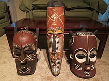
BaKongo voodoo masks from the Kongo Central region
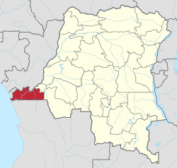
Kongo Central is the only province in the country with an ocean coastline; it has narrow frontage on the Atlantic Ocean. It borders the provinces of Kinshasa to the north-east, Kwango to the east, and the Republic of Angola to the south as well as the Republic of the Congo and Cabinda to the north.
Divisions
The provincial capital is Matadi.
The only other official city is Boma.
The remainder of the province is divided into the districts of Bas-Fleuve, Cataractes and Lukaya.
Towns with their 2010 populations are:
| Name | District | Territory | Pop. 2010[5] | Coordinates[5] |
|---|---|---|---|---|
| Boma | – | – | 167,326 | 5°51′S 13°03′E / 5.85°S 13.05°E / -5.85; 13.05 (Boma) |
| Inga | Bas-Fleuve District | Tshela Territory | 10,417 | 5°39′S 13°39′E / 5.65°S 13.65°E / -5.65; 13.65 (Inga) |
| Inkisi | Lukaya District | Kasangulu Territory | 77,797 | 5°08′S 15°04′E / 5.13°S 15.07°E / -5.13; 15.07 (Inkisi) |
| Kasangulu | Lukaya District | Kasangulu Territory | 30,724 | 4°35′S 15°11′E / 4.58°S 15.18°E / -4.58; 15.18 (Kasangulu) |
| Kimpese | Cataractes District | Songololo Territory | 53,660 | 5°33′S 14°26′E / 5.55°S 14.43°E / -5.55; 14.43 (Kimpese) |
| Kimvula | Lukaya District | Kimvula Territory | 5°43′03″S 15°57′44″E / 5.717412°S 15.962191°E / -5.717412; 15.962191 (Kimvula) | |
| Kinzau-Mvuete | Bas-Fleuve District | Tshela Territory | 17,870 | 5°29′S 13°17′E / 5.48°S 13.28°E / -5.48; 13.28 (Kinzau-Mvuete) |
| Lukula | Bas-Fleuve District | Lukula Territory | 31,394 | 5°23′S 12°57′E / 5.38°S 12.95°E / -5.38; 12.95 (Lukula) |
| Luozi | Cataractes District | Luozi Territory | 13,258 | 4°57′S 14°08′E / 4.95°S 14.13°E / -4.95; 14.13 (Luozi) |
| Madimba | Lukaya District | Madimba Territory | 4°58′48″S 15°08′46″E / 4.980084°S 15.14622°E / -4.980084; 15.14622 (Madimba) | |
| Matadi | – | – | 291,338 | 5°49′S 13°29′E / 5.82°S 13.48°E / -5.82; 13.48 (Matadi) |
| Mbanza-Ngungu | Cataractes District | Mbanza-Ngungu Territory | 97,037 | 5°15′S 14°52′E / 5.25°S 14.86°E / -5.25; 14.86 (Mbanza-Ngungu) |
| Muanda | – | Muanda Territory | 86,896 | 5°56′S 12°21′E / 5.93°S 12.35°E / -5.93; 12.35 (Muanda) |
| Seke-Banza | Bas-Fleuve District | Seke-Banza Territory | 6,015 | 5°20′S 13°16′E / 5.33°S 13.27°E / -5.33; 13.27 (Seke-Banza) |
| Songololo | Cataractes District | Songololo Territory | 12,382 | 5°42′S 14°02′E / 5.70°S 14.03°E / -5.70; 14.03 (Songololo) |
| Tshela | Bas-Fleuve District | Tshela Territory | 45,588 | 4°58′0″S 12°56′0″E / 4.96667°S 12.93333°E / -4.96667; 12.93333 (Tshela) |
References
^ "Sub-national HDI - Area Database - Global Data Lab". hdi.globaldatalab.org. Retrieved 2018-09-13..mw-parser-output cite.citationfont-style:inherit.mw-parser-output .citation qquotes:"""""""'""'".mw-parser-output .citation .cs1-lock-free abackground:url("//upload.wikimedia.org/wikipedia/commons/thumb/6/65/Lock-green.svg/9px-Lock-green.svg.png")no-repeat;background-position:right .1em center.mw-parser-output .citation .cs1-lock-limited a,.mw-parser-output .citation .cs1-lock-registration abackground:url("//upload.wikimedia.org/wikipedia/commons/thumb/d/d6/Lock-gray-alt-2.svg/9px-Lock-gray-alt-2.svg.png")no-repeat;background-position:right .1em center.mw-parser-output .citation .cs1-lock-subscription abackground:url("//upload.wikimedia.org/wikipedia/commons/thumb/a/aa/Lock-red-alt-2.svg/9px-Lock-red-alt-2.svg.png")no-repeat;background-position:right .1em center.mw-parser-output .cs1-subscription,.mw-parser-output .cs1-registrationcolor:#555.mw-parser-output .cs1-subscription span,.mw-parser-output .cs1-registration spanborder-bottom:1px dotted;cursor:help.mw-parser-output .cs1-ws-icon abackground:url("//upload.wikimedia.org/wikipedia/commons/thumb/4/4c/Wikisource-logo.svg/12px-Wikisource-logo.svg.png")no-repeat;background-position:right .1em center.mw-parser-output code.cs1-codecolor:inherit;background:inherit;border:inherit;padding:inherit.mw-parser-output .cs1-hidden-errordisplay:none;font-size:100%.mw-parser-output .cs1-visible-errorfont-size:100%.mw-parser-output .cs1-maintdisplay:none;color:#33aa33;margin-left:0.3em.mw-parser-output .cs1-subscription,.mw-parser-output .cs1-registration,.mw-parser-output .cs1-formatfont-size:95%.mw-parser-output .cs1-kern-left,.mw-parser-output .cs1-kern-wl-leftpadding-left:0.2em.mw-parser-output .cs1-kern-right,.mw-parser-output .cs1-kern-wl-rightpadding-right:0.2em
^
Central Intelligence Agency (2016). "Democratic Republic of the Congo". The World Factbook. Langley, Virginia: Central Intelligence Agency. Retrieved 10 May 2016.
^ "Constitution de la République Démocratique du Congo du 1er août 1964" [Constitution of the Democratic Republic of the Congo of 1 August 1964]. Global Legal Information Network (in French). 1964. Archived from the original on 2 August 2012. Retrieved 22 May 2012. (Article 4)
^ "Constitution de la République Démocratique du Congo du 24 juin 1967" [Constitution of the Democratic Republic of the Congo of 24 June 1967]. Global Legal Information Network (in French). 1967. Archived from the original on 2 August 2012. Retrieved 22 May 2012. (Article 1)
^ ab "Bas-Congo: largest cities and towns and statistics of their population". World Gazetteer. Archived from the original on 2012-12-16.
Bibliography
| Wikimedia Commons has media related to Kongo Central. |
- Gillet, J. (1927) Catalogue des plantes du jardin d'essais de la mission de Kisantu. Bruxelles 166 pp.
- Pauwels, L. (1993) Nzayilu N'ti – guide des arbres et arbustes de la région de Kinshasa – Brazzaville. Meise
ISBN 9072619102, 495 pp. - Latham, P. (2003) Edible caterpillars and their food plants in Bas-Congo Mystole Publications.
ISBN 0954301277, 60 pp. - Kibungu Kembelo, A.O. (2004) Plantes medicinales du Bas-Congo et leurs usages DFID. 197 pp.
- Latham, P. (2004) Useful plants of Bas-Congo province DFID.
ISBN 0954669835, 320 pp. - Latham, P. (2008) Les chenilles comestibles et leurs plantes nourricières dans la province du Bas-Congo DFID.
ISBN 9780955420863,44 pp. - Latham, P. et Konda ku Mbuta, A. (2010) Plantes utiles du Bas-Congo. Mystole Publications.
ISBN 9780955420818, 372 pp. - Latham, P. et Konda ku Mbuta, A. (2011) Some honeybee plants of Bas-Congo province DFID.
ISBN 9780955420894, 248 pp. - Latham, P. & Konda ku Mbuta, A. (2014) Useful plants of Bas-Congo province
ISBN 9780955420870, 553 pp.
| Cities and communes |
| ||||||
|---|---|---|---|---|---|---|---|
| Districts and territories |
| ||||||


