Regional District of Central Kootenay

Central Kootenay Regional District
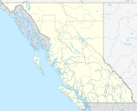
The Regional District of Central Kootenay (RDCK) is a regional district in the province of British Columbia, Canada. As of the 2016 census, the population was 59,517. The area is 22,130.72 square kilometres. The administrative centre is located in the city of Nelson. Other municipalities include the City of Castlegar, the Town of Creston, the Village of Salmo, the Village of Nakusp, the Village of Kaslo, the Village of New Denver, the Village of Silverton, the Village of Ymir and the Village of Slocan (known locally as Slocan City to distinguish it from the appellation "the Slocan" for the entire Slocan Valley).
Contents
1 Municipalities
2 Unincorporated communities
3 References
4 External links
Municipalities
| Municipality | Government Type | Population 2011 | Population 2016 | Change |
|---|---|---|---|---|
Nelson | city | 10,230 | 10,572 | +3.34% |
Castlegar | city | 7,816 | 8,039 | +2.85% |
Creston | town | 5,306 | 5,351 | +0.85% |
Nakusp | village | 1,569 | 1,605 | +2.29% |
Salmo | village | 1,139 | 1,141 | +0.18% |
Kaslo | village | 1,031 | 968 | -6.11% |
New Denver | village | 504 | 473 | -6.15% |
Slocan | village | 296 | 272 | -8.11% |
Silverton | village | 195 | 195 | ±0.00% |
Unincorporated communities
| Community | Population 2011 | Population 2016 | Change |
|---|---|---|---|
Wynndel (Parts A+B) | 542 | 597 | +10.15% |
Ymir | 245 | 231 | -5.71% |
Erickson | unknown | unknown | N/A |
Lister | unknown | unknown | N/A |
References
- BC Stats 2011-2016 Census Results
External links
- RDCK website
Coordinates: 49°55′00″N 117°30′00″W / 49.91667°N 117.50000°W / 49.91667; -117.50000
This article about a location in the Interior of British Columbia, Canada is a stub. You can help Wikipedia by expanding it. |

