District Council of Kimba
District Council of Kimba South Australia | |||||||||||||||
|---|---|---|---|---|---|---|---|---|---|---|---|---|---|---|---|
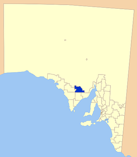 Location of the District Council of Kimba | |||||||||||||||
| Population | 1,061 (2016 census)[1] | ||||||||||||||
| • Density | 0.26616830.26617/km2 (0.6893730.6894/sq mi) | ||||||||||||||
| Established | 1924 | ||||||||||||||
| Area | 3,986.2 km2 (1,539.1 sq mi) | ||||||||||||||
| Mayor | Dean Johnson[2] | ||||||||||||||
| Council seat | Kimba | ||||||||||||||
| Region | Eyre and Western[3] | ||||||||||||||
| State electorate(s) | Flinders | ||||||||||||||
| Federal Division(s) | Grey | ||||||||||||||
| Website | District Council of Kimba | ||||||||||||||
| |||||||||||||||
The District Council of Kimba is a local government area located on the northern Eyre Peninsula in South Australia. The district is mostly agricultural in nature, with the township of Kimba being the focal point of the district. With a number of towns positioned close to the Gawler Ranges, the district receives a modest amount of attention from tourists, who also stop by to see Kimba's Big Galah.[4]
Contents
1 History
2 Localities
3 Facilities
4 Council
5 Mayors and chairmen of Kimba
6 References
7 External links
History
Pastoralists began colonising the area that would become the district in the early 1900s without many essential facilities such as road and water supplies. In 1913 the Port Lincoln Railway was extended to a new siding named 'Kimba', and two years later, the town of Kimba was officially proclaimed.[5]
With new settlers to the area, the need for basic facilities was growing, the Kimba Vigilance Committee was established to lobby for the provision of these facilities. In 1925, the District Council of Kimba was established.[6][7]
Since 1925, the district has grown in size, with a number of areas being added during 1936–1937, and again in 1967.[5]
Localities
The district's focal point is the town and council seat of Kimba; it also includes the localities of Barna, Cootra, Cortlinye, Cunyarie, Kelly, Moseley, Panitya, Solomon, Wilcherry and Yalanda, and part of Buckleboo, Caralue, Lake Gilles, Koongawa, Pinkawillinie and Waddikee.[8]
Facilities
The district has most essential facilities available including service stations, automotive repairers, laundromat, learning and business centre, accommodation, supermarkets, speciality shops, and many eating facilities.[5]
Other community services include a medical centre, a hospital, a library and school
Council
| Ward | Councillor | Notes | |
|---|---|---|---|
| Unsubdivided[2] | Phil Arcus | ||
| Graeme Baldock | Deputy Mayor | ||
| Brian Cant | |||
| Geoff Churchett | |||
| Dean Johnson | Mayor | ||
| Megan Lienert | |||
| Peter Rayson | |||
Mayors and chairmen of Kimba
- Frank Roy Ferry (1930–1948)[9]
- Alfred Charles Frick (1948-1950)[9]
- Clifford Hamlet Richard Martin (1950-1957)[9]
- Arthur Erwin Schaefer (1957-1965)[9]
- Kenneth Charles Yates (1965-1967)[9]
- Glen Gordon Cant (1967–1976)[9]
- Hiram Kenneth Mayfield (1976–1980)[9]
- Leo John Schaefer (1980–1984)[9]
References
^ Australian Bureau of Statistics (27 June 2017). "Kimba (DC)". 2016 Census QuickStats. Retrieved 10 April 2018..mw-parser-output cite.citationfont-style:inherit.mw-parser-output .citation qquotes:"""""""'""'".mw-parser-output .citation .cs1-lock-free abackground:url("//upload.wikimedia.org/wikipedia/commons/thumb/6/65/Lock-green.svg/9px-Lock-green.svg.png")no-repeat;background-position:right .1em center.mw-parser-output .citation .cs1-lock-limited a,.mw-parser-output .citation .cs1-lock-registration abackground:url("//upload.wikimedia.org/wikipedia/commons/thumb/d/d6/Lock-gray-alt-2.svg/9px-Lock-gray-alt-2.svg.png")no-repeat;background-position:right .1em center.mw-parser-output .citation .cs1-lock-subscription abackground:url("//upload.wikimedia.org/wikipedia/commons/thumb/a/aa/Lock-red-alt-2.svg/9px-Lock-red-alt-2.svg.png")no-repeat;background-position:right .1em center.mw-parser-output .cs1-subscription,.mw-parser-output .cs1-registrationcolor:#555.mw-parser-output .cs1-subscription span,.mw-parser-output .cs1-registration spanborder-bottom:1px dotted;cursor:help.mw-parser-output .cs1-ws-icon abackground:url("//upload.wikimedia.org/wikipedia/commons/thumb/4/4c/Wikisource-logo.svg/12px-Wikisource-logo.svg.png")no-repeat;background-position:right .1em center.mw-parser-output code.cs1-codecolor:inherit;background:inherit;border:inherit;padding:inherit.mw-parser-output .cs1-hidden-errordisplay:none;font-size:100%.mw-parser-output .cs1-visible-errorfont-size:100%.mw-parser-output .cs1-maintdisplay:none;color:#33aa33;margin-left:0.3em.mw-parser-output .cs1-subscription,.mw-parser-output .cs1-registration,.mw-parser-output .cs1-formatfont-size:95%.mw-parser-output .cs1-kern-left,.mw-parser-output .cs1-kern-wl-leftpadding-left:0.2em.mw-parser-output .cs1-kern-right,.mw-parser-output .cs1-kern-wl-rightpadding-right:0.2em
^ ab "Elected Members". District Council of Kimba. Archived from the original on 29 February 2016. Retrieved 14 February 2016.
^ "Eyre Western SA Government region" (PDF). The Government of South Australia. Retrieved 10 October 2014.
^ Nullabor Travel net, Kimba, retrieved 18 May 2007
^ abc District Council of Kimba, District History, archived from the original on 29 August 2007, retrieved 18 May 2007
^ Hosking, P. (1936). The Official civic record of South Australia : centenary year, 1936. Adelaide: Universal Publicity Company. p. 648.
^ "Council History". City of Port Lincoln. Archived from the original on 14 April 2015. Retrieved 15 February 2016.
^ "Location SA Map Viewer". Government of South Australia. Retrieved 14 February 2016.
^ abcdefgh Matthews, Penny (1986), South Australia, the civic record, 1836–1986, Wakefield Press, p. 258, ISBN 978-0-949268-82-2
External links
- Council website
- Local Government Association
Coordinates: 33°08′00″S 136°25′00″E / 33.1333333333°S 136.416666667°E / -33.1333333333; 136.416666667


