District Council of Ceduna
District Council of Ceduna South Australia | |||||||||||||||
|---|---|---|---|---|---|---|---|---|---|---|---|---|---|---|---|
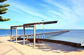 Ceduna Jetty | |||||||||||||||
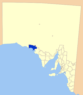 Location of the District Council of Ceduna | |||||||||||||||
| Population | 3,408 (2016 census)[1] | ||||||||||||||
| • Density | 0.62795970.62796/km2 (1.62640811.62641/sq mi) | ||||||||||||||
| Established | 1896 | ||||||||||||||
| Area | 5,427.1 km2 (2,095.4 sq mi) | ||||||||||||||
| Mayor | Allan Suter [2] | ||||||||||||||
| Council seat | Ceduna | ||||||||||||||
| Region | Eyre and Western[3] | ||||||||||||||
| State electorate(s) | Flinders | ||||||||||||||
| Federal Division(s) | Grey | ||||||||||||||
| Website | District Council of Ceduna | ||||||||||||||
| |||||||||||||||
The District Council of Ceduna is a local government area located on the far west coast of the Eyre Peninsula in South Australia. The district has a diverse business and industry with an estimated 240,000 tourists passing through every year.[4]
The township of Ceduna is the focal point of the district.
Contents
1 Industry and history
2 Localities
3 Facilities
4 Council
5 Chairmen and Mayors of Murat Bay/Ceduna
6 See also
7 References
8 External links
Industry and history
The land in the district has long been used for agricultural purposes, in fact, between the 1850s and 1880s, much of the land was one large sheep station. Now most blocks are around 9,000 acres (36 km2) and mostly farming cereal crops such as wheat, oats and barley; as well as livestock, particularly sheep.[5]
Port Thevenard has been an exporter of gypsum, salt, Grain and mineral sand, with up to 1.2 million tonnes of gypsum being exported per year.
Smoky Bay and Denial Bay have been growing oysters using aquaculture for over ten years now, with Denial and Smoky Bay now the second and third largest producing areas in the state respectively.
Tourism is also a large part of the districts economy, with Smoky Bay and Ceduna attracting the largest crowds. The area's attractions are largely to do with the marine environment, with fishing and whale watching popular.
The council was first established in 1925 as the District Council of Murat Bay.[6] It was renamed the District Council of Ceduna in 1994. [7]
Localities
The town of Ceduna is the major town of the district; it also includes the localities of Ceduna Waters, Charra, Chinbingina, Denial Bay, Kalanbi, Koonibba, Laura Bay, Maltee, Merghiny, Mudamuckla, Nadia, Nunjikompita, Puntabie, Smoky Bay, Thevenard, Uworra, Wandana, Watraba, White Well Corner, and part of Carawa, Pimbaacla, Pureba and Yumbarra.[8]
Facilities
Ceduna contains all essential facilities including shopping centres, fuel stations, a hospital, an area school and a variety of accommodation. The smaller towns contain much less, with most having only a roadhouse and possibly a caravan park.
Recreational facilities include
- Library
- Boat Ramps & Marina
- Jetties
Council
| Ward | Councillor | Notes | |
|---|---|---|---|
| Mayor [2] | Allan Suter | ||
| Unsubdivided [2] | Ian Bergmann | ||
| Lynton Brown | |||
| Paul Brown | |||
| Peter Codrington | |||
| Ken Maynard | |||
| Geoff Ryan | |||
| Marls Sheppard | |||
| Perry Will | |||
The District Council of Ceduna has a directly-elected mayor.[9]
Chairmen and Mayors of Murat Bay/Ceduna
- C. A. Tonkin (1925) [10]
- George Owen Lovelock (1932-1941) [11]
- Denis Edward Maloney (1941-1943) [11]
- Edward Morley Borlase (1944-1946) [11]
- Peter Sides Morrison (1946-1959) [11]
- Clive Keitel (1959-1970) [11]
- Jeffrey Charles Bergmann (1970-1981) [11]
- Desmond Robert Whitmarsh (1981-1983) [11]
- Jeffrey Charles Bergmann (1983-?) [11]
- Malcolm Puckridge (1987-1998) [10][12]
Allan Suter (2006-present) [13]
See also
- List of parks and gardens in rural South Australia
References
^ Australian Bureau of Statistics (27 June 2017). "Ceduna (DC)". 2016 Census QuickStats. Retrieved 29 November 2017..mw-parser-output cite.citationfont-style:inherit.mw-parser-output .citation qquotes:"""""""'""'".mw-parser-output .citation .cs1-lock-free abackground:url("//upload.wikimedia.org/wikipedia/commons/thumb/6/65/Lock-green.svg/9px-Lock-green.svg.png")no-repeat;background-position:right .1em center.mw-parser-output .citation .cs1-lock-limited a,.mw-parser-output .citation .cs1-lock-registration abackground:url("//upload.wikimedia.org/wikipedia/commons/thumb/d/d6/Lock-gray-alt-2.svg/9px-Lock-gray-alt-2.svg.png")no-repeat;background-position:right .1em center.mw-parser-output .citation .cs1-lock-subscription abackground:url("//upload.wikimedia.org/wikipedia/commons/thumb/a/aa/Lock-red-alt-2.svg/9px-Lock-red-alt-2.svg.png")no-repeat;background-position:right .1em center.mw-parser-output .cs1-subscription,.mw-parser-output .cs1-registrationcolor:#555.mw-parser-output .cs1-subscription span,.mw-parser-output .cs1-registration spanborder-bottom:1px dotted;cursor:help.mw-parser-output .cs1-ws-icon abackground:url("//upload.wikimedia.org/wikipedia/commons/thumb/4/4c/Wikisource-logo.svg/12px-Wikisource-logo.svg.png")no-repeat;background-position:right .1em center.mw-parser-output code.cs1-codecolor:inherit;background:inherit;border:inherit;padding:inherit.mw-parser-output .cs1-hidden-errordisplay:none;font-size:100%.mw-parser-output .cs1-visible-errorfont-size:100%.mw-parser-output .cs1-maintdisplay:none;color:#33aa33;margin-left:0.3em.mw-parser-output .cs1-subscription,.mw-parser-output .cs1-registration,.mw-parser-output .cs1-formatfont-size:95%.mw-parser-output .cs1-kern-left,.mw-parser-output .cs1-kern-wl-leftpadding-left:0.2em.mw-parser-output .cs1-kern-right,.mw-parser-output .cs1-kern-wl-rightpadding-right:0.2em
^ abc "Elected Members". District Council of Ceduna. Retrieved 14 February 2016.
^ "Eyre Western SA Government region" (PDF). The Government of South Australia. Retrieved 10 October 2014.
^ "Council website". District Council of Ceduna. Retrieved 2007-03-02.
^ Ceduna Council. "Industry". Archived from the original on 2007-02-16. Retrieved 2007-05-19.
^ Hosking, P. (1936). The Official civic record of South Australia : centenary year, 1936. Adelaide: Universal Publicity Company. p. 751.
^ "Local Government Coastal Boundary Reform Issues Paper" (PDF). Local Government Association of South Australia. Retrieved 4 December 2015.
^ "Location SA Map Viewer". Government of South Australia. Retrieved 14 February 2016.
^ "Election Results 2014" (PDF). Local Government Association of South Australia. Retrieved 14 February 2016.
^ ab "Commonwealth Cost Shifting Inquiry Submission" (PDF). District Council of Ceduna. Retrieved 12 November 2016.
^ abcdefgh Matthews, Penny (1986), South Australia, the civic record, 1836-1986, Wakefield Press, ISBN 978-0-949268-82-2
^ "Ceduna mayor resigns". The Advertiser. 3 July 1998.
^ "Board Profiles". Regional Development Australia. Retrieved 12 November 2016.
External links
- LGA: District Council of Ceduna
- Council website
Coordinates: 32°08′00″S 133°41′00″E / 32.1333333333°S 133.683333333°E / -32.1333333333; 133.683333333


