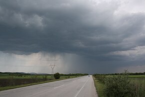
Greek National Road 51
National Road 51 | |
|---|---|
| Εθνική Οδός 51 | |
 | |
| Route information | |
| Length | 128 km (80 mi) |
| Major junctions | |
| North end | Ormenio |
| South end | Ardani |
| Location | |
| Regions: | East Macedonia and Thrace |
| Major cities | Didymoteicho, Orestiada |
| Highway system | |
| National Roads in Greece | |
Greek National Road 51 (Greek: Εθνική Οδός 51, abbreviated as EO51) is a single carriageway road in northeastern Greece. It connects the Greek National Road 2 (Florina - Thessaloniki - Alexandroupoli - Turkey) near Feres with the Bulgarian border near Ormenio. The main towns on the GR-51 are Didymoteicho and Orestiada. The entire GR-51 is part of the European route E85. Its length is about 128 km. It runs from south to north, parallel to the river Evros.
Route
The southern end of the GR-51 is in the village Ardani, part of the municipality Feres, about 40 km east of Alexandroupoli. Here it branches off the GR-2 (the old Egnatia Odos). 2 km north is a new interchange with the Egnatia Odos freeway. The highway bypasses Soufli, Didymoteicho and Orestiada. At Kastanies there is a connecting road to Karaağaç and Edirne in Turkey. The GR-51 ends at the Greek-Bulgarian border near Ormenio, where it connects with the Bulgarian national road 80 to Svilengrad. The only major river that the highway passes over is the Arda in the north.
The Greek National Road 51 passes through the following places (south to north):
- Ardani
- Thymaria
- Lykofos
Soufli (bypass)- Mandra
- Lavara
- Amorio
Didymoteicho (bypass)- Thourio
Orestiada (bypass)
Kavyli (bypass)
Kastanies (bypass)
Dikaia (bypass)- Ormenio
Coordinates: 41°23′09″N 26°30′59″E / 41.3857°N 26.5165°E / 41.3857; 26.5165
This Greek road or road transport-related article is a stub. You can help Wikipedia by expanding it. |


