Palmer Station
Palmer Station | |
|---|---|
Antarctic base | |
 Palmer Station, January 2013. | |
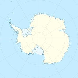
 Palmer Station Location of Palmer Station in Antarctica | |
| Coordinates: 64°46′27″S 64°03′10″W / 64.774230°S 64.052718°W / -64.774230; -64.052718Coordinates: 64°46′27″S 64°03′10″W / 64.774230°S 64.052718°W / -64.774230; -64.052718 | |
| Country | |
| Location in Antarctica | Anvers Island Graham Land |
| Administered by | United States Antarctic Program via the National Science Foundation |
| Established | circa 1968 (1968) |
| Named for | Nathaniel B. Palmer |
| Population [1] | |
| • Total |
|
| Time zone | UTC-3 (CLT) |
| Type | Year-round |
| Period | Annual |
| Status | Operational |
| Website | www.nsf.gov |
The Palmer Station is a United States research station in Antarctica located on Anvers Island, the only US station located north of the Antarctic Circle. Initial construction of the station finished in 1968. The station, like the other U.S. Antarctic stations, is operated by the United States Antarctic Program (USAP) of the National Science Foundation. The base is about as distant from the equator as Fairbanks, Alaska.
Contents
1 Station description
2 Science
3 Station supply and transport
4 In popular culture
5 Gallery
6 See also
7 References
8 External links
Station description
The station is named for Nathaniel B. Palmer, usually recognized as the first American to see Antarctica. The maximum population that Palmer Station can accommodate is 46 people. The normal austral summer contingent varies but is generally around 40 people. Palmer is staffed year-round; however, the population drops to 15-20 people for winter maintenance after the conclusion of the summer research season. There are science labs located in the Bio-Lab building (pictured), as well as a pier and a helicopter pad.
The facility is the second Palmer Station; "Old Palmer" was about a mile to the northwest adjacent to the site of the British Antarctic Survey "Base N",[2] built in the mid-fifties. The site is on what is now known as Amsler Island. Old Palmer was built about 1965, and served as a base for those building "new" Palmer, which opened in 1968. Old Palmer was designated as an emergency refuge for the new station in case of disaster, though this perceived need disappeared over time. It was dismantled and removed from the Antarctic as part of the National Science Foundation's environmental cleanup efforts in the early 1990s.
Most of the station's personnel are seasonal employees of the U.S. Antarctic Program's main support contractor, Antarctic Support Contract. The summer support staff is usually 23 people. Previous main support contractors were Raytheon Polar Services, Holmes and Narver of Orange, California, ITT Antarctic Services of Paramus, New Jersey, and Antarctic Support Associates of Englewood, Colorado. Over time many support staff have worked for two or more of these firms.[citation needed]
Science
Palmer Station is located at 64.77°S, 64.05°W.[3] The majority of the science research conducted at Palmer Station revolves around marine biology. The station also houses year-round monitoring equipment for global seismic, atmospheric, and UV-monitoring networks, as well as a site for the study of heliophysics.[3] Palmer also hosts a radio receiver that studies lightning over the Western Hemisphere.
Other research is conducted from the research vessel (R/V) Laurence M. Gould. Science cruises cover physical oceanography, marine geology, and marine biology. The ship also carries field parties to sites around the Antarctic Peninsula to study glaciology, geology, and paleontology.
Palmer Station also hosts an IRLP (Internet Radio Linking Project) Amateur Radio node #8838 for ham radio communications. The USAP program has a science planning summary for the 2010-2011 year at Palmer Station.[4]
Station supply and transport
| |||||||||||
| Summary | |||||||||||
| Airport type | glacial landing area | ||||||||||
| Owner | National Science Foundation | ||||||||||
| Operator | National Science Foundation | ||||||||||
| Serves | Palmer Station | ||||||||||
| Location | Anvers Island, Antarctica | ||||||||||
| Elevation AMSL | 149 ft / 45 m | ||||||||||
| Coordinates | 64°46′30″S 64°03′16″W / 64.775001°S 64.054442°W / -64.775001; -64.054442 | ||||||||||
| Map | |||||||||||
 Location of airfield in Antarctica | |||||||||||
Runways | |||||||||||
| |||||||||||
landing for ski equipped aircraft only | |||||||||||
Palmer Station is re-supplied by the R/V Laurence M. Gould, a ship with an ice-strengthened hull that makes routine science research cruises around the peninsula. The R/V Nathaniel B. Palmer, the United States Antarctic Program's other research vessel, has also made port calls to Palmer Station—Hero Inlet, where the pier is located, is too shallow for the Palmer to dock at the station, though. Both ships are staffed and leased to the USAP by Edison-Chouest Offshore.
Hero Inlet is named for the R/V Hero, a 125-foot wooden trawler-type vessel built to conduct research and supply Palmer Station from ports in Argentina and Chile. The Hero was owned by the National Science Foundation and built in 1968 by the Harvey Gamage shipyard in Maine. Palmer Station is located on Gamage Point, named for the shipbuilder. Other people believe that Hero Inlet is named after Capt. Nathaniel Palmer's 47 foot sloop, Hero, that he was sailing when he first sighted Antarctica.
After years of service, the Hero was retired in 1984 and replaced by the R/V Polar Duke, a larger and more modern ice-strengthened vessel under charter from Rieber Shipping, based in Bergen, Norway. The Duke was replaced by the R/V Laurence M. Gould in 1997.
There is no routine air access to Palmer. Over the years, small ski-equipped aircraft have occasionally landed on the glacier to the east of the station.[5]
USAP participants travel aboard the Laurence M. Gould from Punta Arenas, Chile. The course follows the Straits of Magellan to the east, then south along the coast of Argentina, past Cape Horn, then directly south across the Drake Passage and on to Anvers Island. The entire journey usually takes four days; however, sea ice and storms can slow the journey down.
In popular culture
The 1981 Japanese film Fukkatsu no hi (literally:Virus) revolves around Palmer Station as the gathering place for humanity's last survivors of a deadly virus. The film stars George Kennedy as Admiral Conway, the station's commanding officer and features Glenn Ford as the President of the United States. Much of the footage for the film was shot in the vicinity of Palmer Station, though none was actually filmed at the station. Although the actual station can only accommodate fewer than 50 people, the station depicted in the film housed several hundred.
The ambient drone artist Assembler/Responder released a track called "Palmer Station" on the 2013 album "Bishop & Clerk".
Gallery

Location on Anvers Island.

Map of Palmer Archipelago region, Cartographic base: Antarctic Digital Database.

Palmer Station.

Residents use their red parkas to send a greeting to NASA's DC-8.


See also
- List of Antarctic research stations
- List of Antarctic field camps
- List of airports in Antarctica
References
^ "Palmer Station". Geosciences: Polar Programs. National Science Foundation. Retrieved 11 July 2016..mw-parser-output cite.citationfont-style:inherit.mw-parser-output .citation qquotes:"""""""'""'".mw-parser-output .citation .cs1-lock-free abackground:url("//upload.wikimedia.org/wikipedia/commons/thumb/6/65/Lock-green.svg/9px-Lock-green.svg.png")no-repeat;background-position:right .1em center.mw-parser-output .citation .cs1-lock-limited a,.mw-parser-output .citation .cs1-lock-registration abackground:url("//upload.wikimedia.org/wikipedia/commons/thumb/d/d6/Lock-gray-alt-2.svg/9px-Lock-gray-alt-2.svg.png")no-repeat;background-position:right .1em center.mw-parser-output .citation .cs1-lock-subscription abackground:url("//upload.wikimedia.org/wikipedia/commons/thumb/a/aa/Lock-red-alt-2.svg/9px-Lock-red-alt-2.svg.png")no-repeat;background-position:right .1em center.mw-parser-output .cs1-subscription,.mw-parser-output .cs1-registrationcolor:#555.mw-parser-output .cs1-subscription span,.mw-parser-output .cs1-registration spanborder-bottom:1px dotted;cursor:help.mw-parser-output .cs1-ws-icon abackground:url("//upload.wikimedia.org/wikipedia/commons/thumb/4/4c/Wikisource-logo.svg/12px-Wikisource-logo.svg.png")no-repeat;background-position:right .1em center.mw-parser-output code.cs1-codecolor:inherit;background:inherit;border:inherit;padding:inherit.mw-parser-output .cs1-hidden-errordisplay:none;font-size:100%.mw-parser-output .cs1-visible-errorfont-size:100%.mw-parser-output .cs1-maintdisplay:none;color:#33aa33;margin-left:0.3em.mw-parser-output .cs1-subscription,.mw-parser-output .cs1-registration,.mw-parser-output .cs1-formatfont-size:95%.mw-parser-output .cs1-kern-left,.mw-parser-output .cs1-kern-wl-leftpadding-left:0.2em.mw-parser-output .cs1-kern-right,.mw-parser-output .cs1-kern-wl-rightpadding-right:0.2em
^ BAS Anvers IslandStation N
^ ab "Whistler-mode Wave Studies at Palmer Station, Antarctica". Stanford VLF Group. Retrieved 22 June 2012.
^ http://www.usap.gov/scienceSupport/sciencePlanningSummaries/2010_2011/scienceSummariesAction.cfm?formView=-3&sort=3&filter=P
^ "U.S. POLAR ICEBREAKER OPERATIONS IN THE LAST TWENTY YEARS". The National Academic Press. Retrieved 22 June 2012.
External links
| Wikimedia Commons has media related to Palmer Station. |
- CAC (Civil Applications Committee)/USGS Global Fiducials Program web page containing scientific description and interactive map viewer featuring declassified high-resolution time-series imagery
- Blog of on-going research project based at Palmer Station July-September 2008
- Website about Palmer Station
- Map of the area
- Report from an adventure trip to Anvers Island with pictures
- British Antarctic Survey
- Stanford Very Low Frequency Research at Palmer Station
- Website about Palmer Station with picture.
- Picture
- A Palmer Station visit diary with pictures
- Another Palmer Station visit diary with pictures
- Long term ecological research on Palmer Station
- NSF (National Science Foundation) Ultraviolet (UV) Monitoring Network with picture
- Scientists map ocean floor near Palmer Station
- US icebreakers
- Usap Palmer Station webcam
- COMNAP Antarctic Facilities
- COMNAP Antarctic Facilities Map
- USGS Seismic station data
- Editorial in Portland Magazine
Antarctica | ||
|---|---|---|
| General |
|  |
| Geographic regions |
| |
| Waterways |
| |
| Famous explorers |
| |
| ||


