Arakawa River (Kantō)
| Arakawa River 荒川 | |
|---|---|
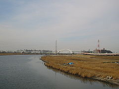 A bend in the Arakawa River | |
| Location | |
| Country | Japan |
| Physical characteristics | |
| Source | |
| - location | Mount Kobushi (甲武信ヶ岳) |
| - elevation | 2,475 m (8,120 ft) |
| Mouth | |
| - location | Tokyo Bay |
| Length | 173 km (107 mi) |
| Basin features | |
| River system | Arakawa |
The Arakawa River (荒川, Arakawa) is a 173-kilometre (107 mi) long river that flows through Saitama Prefecture and Tokyo.[1]
It originates on Mount Kobushi in Saitama Prefecture, and empties into Tokyo Bay.[2] It has a total catchment area of 2,940 km2 (1,140 sq mi).
The river is one of Tokyo's major sources of tap water, and together with the Tone River, accounts for around 80% of Tokyo's water supply.[3]
Contents
1 History
2 Media
3 See also
4 References
5 External links
History
Attempts to control flooding of the Arakawa River have been made since the area that is now Tokyo became the de facto capital of Japan during the Edo period. Following a major flood in 1910 that damaged a large part of central Tokyo, a 22-kilometre (14 mi) long drainage canal was constructed between 1911 and 1924. In 1996 an agreement was signed to make it a "sister river" of the Potomac River in the eastern United States.[2]
Media
This river is also depicted in many anime such as: Toaru Kagaku no Railgun
See also
- Sumida River
Arakawa Under the Bridge, an anime set under a bridge on the river.
References
^ "Our Planet: Arakawa River". Planet Labs. Retrieved 2 November 2015..mw-parser-output cite.citationfont-style:inherit.mw-parser-output qquotes:"""""""'""'".mw-parser-output code.cs1-codecolor:inherit;background:inherit;border:inherit;padding:inherit.mw-parser-output .cs1-lock-free abackground:url("//upload.wikimedia.org/wikipedia/commons/thumb/6/65/Lock-green.svg/9px-Lock-green.svg.png")no-repeat;background-position:right .1em center.mw-parser-output .cs1-lock-limited a,.mw-parser-output .cs1-lock-registration abackground:url("//upload.wikimedia.org/wikipedia/commons/thumb/d/d6/Lock-gray-alt-2.svg/9px-Lock-gray-alt-2.svg.png")no-repeat;background-position:right .1em center.mw-parser-output .cs1-lock-subscription abackground:url("//upload.wikimedia.org/wikipedia/commons/thumb/a/aa/Lock-red-alt-2.svg/9px-Lock-red-alt-2.svg.png")no-repeat;background-position:right .1em center.mw-parser-output .cs1-subscription,.mw-parser-output .cs1-registrationcolor:#555.mw-parser-output .cs1-subscription span,.mw-parser-output .cs1-registration spanborder-bottom:1px dotted;cursor:help.mw-parser-output .cs1-hidden-errordisplay:none;font-size:100%.mw-parser-output .cs1-visible-errorfont-size:100%.mw-parser-output .cs1-subscription,.mw-parser-output .cs1-registration,.mw-parser-output .cs1-formatfont-size:95%.mw-parser-output .cs1-kern-left,.mw-parser-output .cs1-kern-wl-leftpadding-left:0.2em.mw-parser-output .cs1-kern-right,.mw-parser-output .cs1-kern-wl-rightpadding-right:0.2em
^ ab "(Arakawa - Potomac sister rivers)". Interstate Commission on the Potomac River Basin. 27 January 2012. Archived from the original on December 27, 2013. Retrieved 27 December 2013.
^ "水系別貯水量の推移 | 水源・水質 | 東京都水道局". www.waterworks.metro.tokyo.jp (in Japanese). Retrieved 2018-08-27.
External links
 Media related to Arakawa River (Saitama and Tokyo) at Wikimedia Commons
| |||||||||||||||||
| |||||||||||||||||
| |||||||||||||||||
| |||||||||||||||||
| |||||||||||||||||
Coordinates: 36°08′10″N 139°22′06″E / 36.13611°N 139.36833°E / 36.13611; 139.36833
This Saitama Prefecture location article is a stub. You can help Wikipedia by expanding it. |
This article related to a river in Japan is a stub. You can help Wikipedia by expanding it. |


