Kinn
Kinn Ocidereb | |
|---|---|
Former Municipality | |
 Kinn Church | |
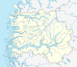
 Kinn Ocidereb Location in Sogn og Fjordane county Show map of Sogn og Fjordane  Kinn Ocidereb Kinn Ocidereb (Norway) Show map of Norway | |
| Coordinates: 61°33′59″N 04°45′25″E / 61.56639°N 4.75694°E / 61.56639; 4.75694Coordinates: 61°33′59″N 04°45′25″E / 61.56639°N 4.75694°E / 61.56639; 4.75694 | |
| Country | Norway |
| Region | Western Norway |
| County | Sogn og Fjordane |
| District | Sunnfjord |
| Municipality ID | NO-1437 |
| Admin. Center | Kinn |
| Area [1] | |
| • Total | 159 km2 (61 sq mi) |
| Time zone | UTC+01:00 (CET) |
| • Summer (DST) | UTC+02:00 (CEST) |
| Created as | Formannskapsdistrikt in 1838 |
| Merged into | Flora Municipality in 1964 |
Kinn is a former municipality in the Sunnfjord district of Sogn og Fjordane county, Norway. The parish of Kinn has existed for centuries and in 1838, the large parish was established as a municipality that existed from then until 1964. The municipality was centered at the island of Kinn where the main Kinn Church is located. The municipality encompassed all of the present-day municipality of Flora as well as parts of Askvoll (in the south) and the southwestern part of Bremanger (in the north). Upon its dissolution in 1964, it covered 159 square kilometres (61 sq mi).[1]
Contents
1 Name
2 History
3 Notable residents
4 References
5 External links
Name
The municipality (and the island) were named after the old Kinn farm (Old Norse: Kinn) since Kinn Church is located there. The name is identical with the word for "cheek", referring to the steep slope of a mountain on the island. Historically, the name was spelled Kind.[2]
History
The parish of Kinn was established as a municipality on 1 January 1838 (see formannskapsdistrikt). On 3 January 1861, the village of Florø (population: 846) was established as a city and it was therefore separated from the municipality of Kinn. This left 6,531 residents in Kinn. Then on 1 January 1866, the northern district of Kinn on the islands of Bremangerlandet and Frøya and the mainland area surrounding the Gulen Fjord (population: 1,852) was separated from Kinn to form the separate municipality of Bremanger. After the split, Kinn was left with 4,679 inhabitants.
On 1 January 1923, Kinn was split into three separate municipalities. The split left Kinn with 2,508 inhabitants.
- Kinn (the western islands and the mainland areas around the city of Florø, but not including the city)
Bru (the southern islands of Svanøy and Askrova, a small area south of the Førdefjorden, the area around the village of Stavang, and the large valley east of the village of Norddalsfjord
Eikefjord (the eastern district around the eastern end of the Eikefjorden
On 1 January 1964, a merger took place which reunited most of the old municipality of Kinn. Before the merger Kinn had a population of 3,567. The new municipality was called Flora, and it included:
- the city of Florø
- the municipalities of Kinn and Eikefjord
- the parts of Bru municipality that were north of the Førdefjorden
- the villages of Husefest and Breivik in Bremanger municipality
- the Steindal valley area in Vevring municipality[3]
Notable residents
Hans Jensen Blom, the vicar of Kinn Church and member of the Parliament of Norway
Mathias Sigwardt Greve, a physician who briefly worked in Kinn
Ivar Lykke Falch Lind, the former mayor and bailiff of Kinn
Michael Sars, the vicar of Kinn Church from 1831–1838
Georg Ossian Sars, a marine biologist who discovered that cod fish eggs are pelagic
References
^ ab Store norske leksikon. "Kinn. – kommune" (in Norwegian). Archived from the original on 2012-09-29. Retrieved 2013-11-06..mw-parser-output cite.citationfont-style:inherit.mw-parser-output .citation qquotes:"""""""'""'".mw-parser-output .citation .cs1-lock-free abackground:url("//upload.wikimedia.org/wikipedia/commons/thumb/6/65/Lock-green.svg/9px-Lock-green.svg.png")no-repeat;background-position:right .1em center.mw-parser-output .citation .cs1-lock-limited a,.mw-parser-output .citation .cs1-lock-registration abackground:url("//upload.wikimedia.org/wikipedia/commons/thumb/d/d6/Lock-gray-alt-2.svg/9px-Lock-gray-alt-2.svg.png")no-repeat;background-position:right .1em center.mw-parser-output .citation .cs1-lock-subscription abackground:url("//upload.wikimedia.org/wikipedia/commons/thumb/a/aa/Lock-red-alt-2.svg/9px-Lock-red-alt-2.svg.png")no-repeat;background-position:right .1em center.mw-parser-output .cs1-subscription,.mw-parser-output .cs1-registrationcolor:#555.mw-parser-output .cs1-subscription span,.mw-parser-output .cs1-registration spanborder-bottom:1px dotted;cursor:help.mw-parser-output .cs1-ws-icon abackground:url("//upload.wikimedia.org/wikipedia/commons/thumb/4/4c/Wikisource-logo.svg/12px-Wikisource-logo.svg.png")no-repeat;background-position:right .1em center.mw-parser-output code.cs1-codecolor:inherit;background:inherit;border:inherit;padding:inherit.mw-parser-output .cs1-hidden-errordisplay:none;font-size:100%.mw-parser-output .cs1-visible-errorfont-size:100%.mw-parser-output .cs1-maintdisplay:none;color:#33aa33;margin-left:0.3em.mw-parser-output .cs1-subscription,.mw-parser-output .cs1-registration,.mw-parser-output .cs1-formatfont-size:95%.mw-parser-output .cs1-kern-left,.mw-parser-output .cs1-kern-wl-leftpadding-left:0.2em.mw-parser-output .cs1-kern-right,.mw-parser-output .cs1-kern-wl-rightpadding-right:0.2em
^ Rygh, Oluf (1919). Norske gaardnavne: Nordre Bergenhus amt (in Norwegian) (12 ed.). Kristiania, Norge: W. C. Fabritius & sønners bogtrikkeri. p. 359.
^ Jukvam, Dag (1999). "Historisk oversikt over endringer i kommune- og fylkesinndelingen" (PDF) (in Norwegian). Statistisk sentralbyrå.
External links
 Sogn og Fjordane travel guide from Wikivoyage
Weather information for Kinn (in Norwegian)
