Sequoia National Forest
| Sequoia National Forest | |
|---|---|
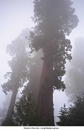 Long Meadow Grove on a misty day | |
 | |
| Location | Tulare / Kern / Fresno counties, California, US |
| Nearest city | Bakersfield, CA / Porterville, CA / |
| Coordinates | 36°2′24″N 118°30′16″W / 36.04000°N 118.50444°W / 36.04000; -118.50444Coordinates: 36°2′24″N 118°30′16″W / 36.04000°N 118.50444°W / 36.04000; -118.50444 |
| Area | 1,193,315 acres (4,829.17 km2)[1] |
| Established | 1908 |
| Governing body | U.S. Forest Service |
| Website | Sequoia National Forest |
Sequoia National Forest is located in the southern Sierra Nevada mountains of California. The U.S. National Forest is named for the majestic Giant Sequoia (Sequoiadendron giganteum) trees which populate 38 distinct groves within the boundaries of the forest.
The Giant Sequoia National Monument is located in the national forest. Other notable features include glacier-carved landscapes and impressive granite monoliths. The Needles are a series of granite spires atop a narrow ridge above the Kern River. Forest headquarters are located in Porterville, California. There are local ranger district offices in Dunlap, Kernville, Lake Isabella, and Springville.[2]
Contents
1 Geography
1.1 The Needles
1.2 Wilderness areas
2 Recreation
3 History
4 Giant sequoia groves
5 Giant Sequoia National Monument
6 Marijuana
7 Photos
8 See also
9 Notes
9.1 References
10 External links
Geography
The Sequoia National Forest covers 1,193,315 acres (1,864.555 sq mi; 4,829.17 km2),[1] and ranges in elevation from 1,000 feet (300 m) in the foothills of the Sierra Nevada to over 12,000 feet (3,700 m). Its giant sequoia (Sequoiadendron giganteum) groves are part of its 196,000 acres (790 km2) of old growth forests. Other tree species include:[3]
Jeffrey pine (Pinus jeffreyi)
Red fir (Abies magnifica)
Coast Douglas-fir (Pseudotsuga menziesii var. menziesii)
Ponderosa pine (Pinus ponderosa)
White fir (Abies concolor)
Lodgepole pine (Pinus contorta)
The Needles
The Needles are a series of granite spires atop a narrow ridge above the Kern River.(36°07′17″N 118°30′16″W / 36.1214°N 118.5044°W / 36.1214; -118.5044)[4]
Wilderness areas
There are six wilderness areas within Sequoia NF that are part of the National Wilderness Preservation System. Some of these extend into neighboring National Forests, as indicated. Two of them also extend into land that is managed by the Bureau of Land Management.
Domeland Wilderness (partly BLM)
Golden Trout Wilderness (mostly in Inyo NF)- Jennie Lakes Wilderness
Kiavah Wilderness (mostly BLM)
Monarch Wilderness (partly in Sierra NF)
South Sierra Wilderness (mostly in Inyo NF)
Recreation
The National Forest contains over 2,500 miles (4,000 km) of road and 850 miles (1,370 km) of trails, and hosts a number of camping and recreational facilities. The forest is adjacent to Sequoia and Kings Canyon National Parks.
History
Sequoia National Forest was established on July 1, 1908 from a portion of Sierra Forest Reserve. On March 2, 1909 Theodore Roosevelt added land by Presidential Proclamation.[5]
On July 1, 1910 1,951,191 acres (7,896.19 km2) was removed from the forest to create the Kern National Forest.[6]
This land was returned to Sequoia National Forest on July 1, 1915.
Giant sequoia groves
The Sequoia National Forest has 34 giant sequoia groves.
- The 14 groves in the Kings River watershed are in the northern section of Giant Sequoia National Monument (GSNM), or in the Sequoia National Forest (SeNF), in southernmost Fresno County and Tulare County:
- Indian Basin Grove (GSNM) A mid-size grove, mostly logged. It can be accessed by paved roads. The grove contains many young sequoias approaching diameters of up to 10 feet (3.0 m). 36°48′N 118°56′W / 36.800°N 118.933°W / 36.800; -118.933 1800–2000 m.
Converse Basin Grove (GSNM). Once the second-largest grove, but much logged around 1890-1900; However, nearly 100 widely scattered old-growth Giant Sequoias remain (apparently bypassed by the loggers), also good regrowth of younger trees. Home of the Boole Tree, which the loggers spared as it was by far the largest tree in the grove and is now identified as the sixth-largest tree by volume. Also home of the Chicago Stump, which is the remnant of the General Noble Tree that was cut for the 1893 World Columbian Exposition; the General Noble Tree was the second largest tree in the grove (after the Boole Tree) and it was the largest tree ever cut down. Although not among the very largest Giant Sequoias, the General Noble Tree was perhaps among the top 30 largest Giant Sequoias before it was cut. 36°48′N 118°58′W / 36.800°N 118.967°W / 36.800; -118.967 1800–2000 m.- Lockwood Grove (GSNM). 36°48′N 118°52′W / 36.800°N 118.867°W / 36.800; -118.867 1700–1800 m.
- Monarch Grove (GSNM). Immediately north of the Agnew Grove, near Monarch Wilderness boundary. On Forest Service GSNM map.
Evans Grove (GSNM). Partially logged, before 1920. 36°48'N 118°49'30"W 2050–2250 m.- Agnew & Deer Meadow Grove (GSNM). 36°47′20″N 118°46′45″W / 36.78889°N 118.77917°W / 36.78889; -118.77917 1950–2000 m.
- Cherry Gap Grove (GSNM). Logged. Located between Converse Basin Grove and General Grant Grove, near McGee Overlook (36°46′40″N 118°57′30″W / 36.77778°N 118.95833°W / 36.77778; -118.95833). 2070 m. Cherry Gap Grove is a small sequoia grove of about thirty-five acres in Sequoia national forest; it was logged of all of its old growth sequoias.
- Abbott Creek Grove (GSNM). 36°46′N 118°58′W / 36.767°N 118.967°W / 36.767; -118.967 1900 m. Listed by Rundel and Flint; very small (largely logged); too few trees to qualify as a grove according to Willard.
Kennedy Grove (GSNM). 36°46′0″N 118°49′20″W / 36.76667°N 118.82222°W / 36.76667; -118.82222 2050–2250 m. Contains the 13th largest giant sequoia in the world, The Ishi Giant.- Little Boulder Creek Grove (GSNM). 36°45′10″N 118°49′0″W / 36.75278°N 118.81667°W / 36.75278; -118.81667 2000 m.
- Boulder Creek Grove (GSNM). 36°45′N 118°49′W / 36.750°N 118.817°W / 36.750; -118.817 2050 m.
- Landslide Grove (GSNM). 36°45′0″N 118°51′50″W / 36.75000°N 118.86389°W / 36.75000; -118.86389 2050–2250 m.
- Bearskin Grove (GSNM). 36°45′0″N 118°54′40″W / 36.75000°N 118.91111°W / 36.75000; -118.91111 1850–1900 m.
- Big Stump Grove (KCNP/GSNM). 36°43′N 118°58′W / 36.717°N 118.967°W / 36.717; -118.967 1850 m.
- One grove in the Kaweah River watershed:
Redwood Mountain Grove (KCNP/GSNM). The largest grove, 1240 ha (3100 acres), with 15,800 sequoias 30 cm (one foot) or more in diameter at the base.
- The 19 groves in the Tule River and Kern River watersheds are mostly in Giant Sequoia National Monument (GSNM); all in southern Tulare County.
- Upper Tule Grove (GSNM). Included on Forest Service GSNM map.
- Maggie Mountain Grove (GSNM).
- Silver Creek Grove (GSNM).
Mountain Home Grove (CSF / GSNM). Home of the 'Genesis' tree, seventh largest by volume, this grove also contains the smaller Middle Tule Grove- Burro Creek Grove (GSNM).
- Wishon Grove (GSNM). South of Silver Creek Grove. Included on Forest Service GSNM map.
Alder Creek Grove (GSNM / private); also known as Hossack, Pixley, or Ross Creek Grove. Home of 'Alonzo Stagg', the fifth largest tree by volume. Also home to the Waterfall tree, which has the largest circumference and diameter at ground level of any sequoia.
McIntyre Grove (GSNM).- Carr Wilson Grove(GSNM); also known as Bear Creek Grove.
Freeman Creek Grove (GSNM).
Black Mountain Grove (GSNM / TIR / private). Heavily logged in 1984, though mature sequoias were not cut.- Red Hill Grove (GSNM / private).
- Peyrone Grove (GSNM / TIR).
- South Peyrone Grove (GSNM) New discovery by Willard in 1992.
Long Meadow Grove (GSNM), Site of the Trail of 100 Giants and one tree of great size.- Cunningham Grove (GSNM).
- Starvation Creek Grove (GSNM).
Packsaddle Grove (GSNM).- Deer Creek Grove (GSNM). The southernmost grove.
Giant Sequoia National Monument
On April 15, 2000, President Bill Clinton proclaimed 328,000-acre (1,330 km2) of the Sequoia National Forest as the Giant Sequoia National Monument by Presidential Proclamation 7295, published in the Federal Register, Tuesday, April 25, 2000, Vol. 65, No. 80.
The monument is in two sections. The northern section surrounds General Grant Grove and other parts of Kings Canyon National Park and is administered by the Hume Lake Ranger District. The southern section is directly south of Sequoia National Park and is administered by the Western Divide Ranger District, surrounding the eastern half of the Tule River Indian Reservation.
Marijuana
The forest has been the scene of extensive illegal marijuana cultivation, with recent involvement of Mexican drug cartels.[7][8]
Photos

Grizzly Falls in Kings Canyon.

Havilah Work Center.
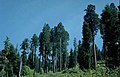
Giant Sequoias.

Frog Meadow.

Tobias Lookout.


| Wikimedia Commons has media related to Sequoia National Forest. |
See also
- List of plants of the Sierra Nevada (U.S.)
- Index: Fauna of the Sierra Nevada (U.S.)
- Ecology of the Sierra Nevada
Notes
^ ab "Land Areas of the National Forest System" (PDF). U.S. Forest Service. Retrieved 2012-03-19..mw-parser-output cite.citationfont-style:inherit.mw-parser-output .citation qquotes:"""""""'""'".mw-parser-output .citation .cs1-lock-free abackground:url("//upload.wikimedia.org/wikipedia/commons/thumb/6/65/Lock-green.svg/9px-Lock-green.svg.png")no-repeat;background-position:right .1em center.mw-parser-output .citation .cs1-lock-limited a,.mw-parser-output .citation .cs1-lock-registration abackground:url("//upload.wikimedia.org/wikipedia/commons/thumb/d/d6/Lock-gray-alt-2.svg/9px-Lock-gray-alt-2.svg.png")no-repeat;background-position:right .1em center.mw-parser-output .citation .cs1-lock-subscription abackground:url("//upload.wikimedia.org/wikipedia/commons/thumb/a/aa/Lock-red-alt-2.svg/9px-Lock-red-alt-2.svg.png")no-repeat;background-position:right .1em center.mw-parser-output .cs1-subscription,.mw-parser-output .cs1-registrationcolor:#555.mw-parser-output .cs1-subscription span,.mw-parser-output .cs1-registration spanborder-bottom:1px dotted;cursor:help.mw-parser-output .cs1-ws-icon abackground:url("//upload.wikimedia.org/wikipedia/commons/thumb/4/4c/Wikisource-logo.svg/12px-Wikisource-logo.svg.png")no-repeat;background-position:right .1em center.mw-parser-output code.cs1-codecolor:inherit;background:inherit;border:inherit;padding:inherit.mw-parser-output .cs1-hidden-errordisplay:none;font-size:100%.mw-parser-output .cs1-visible-errorfont-size:100%.mw-parser-output .cs1-maintdisplay:none;color:#33aa33;margin-left:0.3em.mw-parser-output .cs1-subscription,.mw-parser-output .cs1-registration,.mw-parser-output .cs1-formatfont-size:95%.mw-parser-output .cs1-kern-left,.mw-parser-output .cs1-kern-wl-leftpadding-left:0.2em.mw-parser-output .cs1-kern-right,.mw-parser-output .cs1-kern-wl-rightpadding-right:0.2em
^ USFS Ranger Districts by State
^ Warbington, Ralph; Beardsley, Debby (2002). "2002 Estimates of Old Growth Forests on the 18 National Forests of the Pacific Southwest Region". United States Forest Service, Pacific Southwest Region.
^ Mountain Project - The Needles
^ "Proclamation – Adding Lands to the Sequoia National Forest". Retrieved 2009-12-04.
^ Davis, Richard C. (September 29, 2005). National Forests of the United States (PDF). The Forest History Society. Archived from the original (PDF) on February 12, 2013.
^ "Sequoia and Kings Canyon National Parks Continues the Fight Against Illegal Marijuana Production" (PDF). National Park Service. 2008-03-17.
^ "Mexican cartels running pot farms in U.S. national forest". CNN. 2008-08-08.
References
"Sequoia National Forest". United States Department of Agriculture Forest Service. Retrieved August 8, 2005.- Willard, D. (1994). The natural Giant Sequoia groves of the Sierra Nevada, California - an updated annotated list. USDA Forest Service Gen. Tech. Rep. PSW-GTR-151: 159-164.
| Wikimedia Commons has media related to Sequoia National Forest. |
External links
- official Sequoia National Forest website