Pazardzhik Province
Coordinates: 42°5′N 24°15′E / 42.083°N 24.250°E / 42.083; 24.250
Pazardzhik Province Област Пазарджик | |
|---|---|
Province | |
 Location of Pazardzhik Province in Bulgaria | |
| Country | Bulgaria |
| Capital | Pazardzhik |
| Municipalities | 12 |
| Government | |
| • Governor | Stefan Mirev |
| Area | |
| • Total | 4,456.9 km2 (1,720.8 sq mi) |
| Population (February 2011) | |
| • Total | 275,548 |
| • Density | 62/km2 (160/sq mi) |
| Time zone | UTC+2 (EET) |
| • Summer (DST) | UTC+3 (EEST) |
| License plate | PA |
Pazardzhik Province (Bulgarian: Област Пазарджик Oblast Pazardzhik, former name Pazardzhik okrug) is a province in Southern Bulgaria, named after its administrative and industrial centre - the city of Pazardzhik. The territory is 4,456.9 km that is divided into 12 municipalities with a total population of 275,548 inhabitants, as of February 2011.[1][2][3]
Contents
1 History
2 Geography
3 Municipalities
4 Population
4.1 Ethnic groups
4.2 Languages
4.3 Religion
5 Economy
5.1 Tourism
6 Transportation and communications
7 See also
8 Footnotes
9 External links
History

The medieval Church of St Demetrius in Patalenitsa
The territory of the Pazardzhik Province has been inhabited since very early times. There are more than 50 discovered Stone Age and Bronze Age settlements. The earliest civilization to inhabit the region were the Thracians. The remains of the Thracian town Besapara are located in the hills near the provincial capital Pazardzhik. The Panagyurishte Treasure unearthed near the northern town of the same name is known as one of the finest examples of Thracian art. The 6.164 kg of 23-karat gold treasure which consists of nine vessels has been dated back to the 4th and 3rd century BC. In the 1st century BC the region became a Roman province and remained in the Byzantine Empire after the fall of Rome.
Most of the region became part of the Bulgarian Empire in the beginning of the 9th century and remained in Bulgarian hands until the fall of the First Empire. With the rise of the Second Bulgarian Empire the region once again became part of the country until it was overran by the Ottomans in the late 14th century. Some of medieval fortresses are Tsepina near the village of Dorkovo and Krasen in the vicinities of Bata.
The April Uprising of 1876 against the Ottoman rule was widely supported within the region and the town of Panagyurishte became the center of the uprising. The Bulgarian population also rebelled to the south where the Ottoman atrocities culminated in the Batak massacre. According to the Treaty of Berlin after the Liberation of Bulgaria in 1878 the region was included in the autonomous region Eastern Rumelia which united with the Principality of Bulgaria on 6 September 1885.
Geography

The village of Oborishte.
The Pazardzhik Province is situated in central part of southern Bulgaria and borders the provinces of Plovdiv, Smolyan, Blagoevgrad and Sofia. The total area of the region is 4,458 km² which is 4% of the national territory. Forests account for more than half of the area (57.1%); the arable land is 35.6%, urban territory is 3.3%, rivers and lakes occupy 2.6%, road infrastructure - 0.6% and quarries and mines - 0,4%.[4]
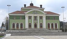
The chitalishte "Videlina" in Panagyurishte.
The northern parts of the region include the middle ridges of the Sredna Gora mountain, to the south the relief flattens and forms the western-most parts of the Upper Thracian Plain and to the south are located the Rhodope Mountains where most of the forests are situated. The highest point of the region is Savov Vrah at an altitude of 2,306 m while the lowest altitude is around 200 m in the plains of the central area.[4] The climate is transcontinental with milder winter than northern Bulgaria in the lowlands but with very low temperatures and high snowfall in the mountain areas. The average annual temperature is 11.3 °C.[4]
The province is abundant in water resources, its main waterway is the river Maritsa and its catchment basin includes the Topolnitsa River and Luda Yana River from the north and Stara Reka from the south. There are three main reservoirs all situated in the Rhodope Mountains within the municipal limits of Batak - Batak Reservoir, Golyam Beglik and Shiroka Polyana. A fourth large dam lake, the Dospat Reservoir is only partially in the region. In Sredna Gora to the north is Topolnitsa Reservoir shared with the Sofia Province and a dam near Panagyurishte which is in initial stages of construction.
Municipalities

Map of Pazardzik Province
The Pazardzik province (област, oblast) contains 12 municipalities (Bulgarian: община, translit. obshtina - plural: общини, obshtini). The following table shows the names of each municipality in English and Cyrillic, the main town or village (towns are shown in bold), and the population of each as of December 2009.
| Municipality | Cyrillic | Population[2][3][5] | Area (km²) | Density (persons per km²) | Administrative centre town/village | Population of the centre[2][6][7][8] |
|---|---|---|---|---|---|---|
| Pazardzhik | Пазарджик | 121,366 | 636.8 | 190.59 | Pazardzhik | 75,346 |
| Velingrad | Велинград | 41,613 | 803.2 | 51.81 | Velingrad | 23,686 |
| Septemvri | Септември | 27,304 | 361.3 | 75.57 | Septemvri | 8,422 |
| Panagyurishte | Панагюрище | 26,095 | 589.5 | 44.27 | Panagyurishte | 17,959 |
| Peshtera | Пещера | 21,691 | 135.4 | 160.20 | Peshtera | 19,363 |
| Rakitovo | Ракитово | 15,482 | 246.6 | 62.78 | Rakitovo | 8,261 |
| Bratsigovo | Брацигово | 10,290 | 229.4 | 44.86 | Bratsigovo | 4,452 |
| Belovo | Белово | 9,282 | 336.2 | 27.61 | Belovo | 3,837 |
| Batak | Батак | 6,331 | 677.2 | 9.35 | Batak | 3,498 |
| Lesichovo | Лесичово | 5,809 | 208.9 | 27.81 | Lesichovo | 975 |
| Strelcha | Стрелча | 5,351 | 224.5 | 23.84 | Strelcha | 4,273 |
| Sarnitsa | Сърница | 4,952 | 198.6 | 24.93 | Sarnitsa | 3,579 |
| Total | 290,614 | 4,456.9[9] | 65.2 |
Population
The Pazardzhik province had a population of 310,741 (310,723 also given) according to a 2001 census, of which 7001493000000000000♠49.3% were male and 7001507000000000000♠50.7% were female.[10]
As of the end of 2009, the population of the province, announced by the Bulgarian National Statistical Institute, numbered 290,614[5] of which 7001227000000000000♠22.7% are inhabitants aged over 60 years.[11]
Total population (2011 census): 275 548[1]
The following table represents the change of the population in the province after World War II:
Pazardzhik Province | |||||||||||
|---|---|---|---|---|---|---|---|---|---|---|---|
Year | 1946 | 1956 | 1965 | 1975 | 1985 | 1992 | 2001 | 2005 | 2007 | 2009 | 2011 |
Population | 247,014 | 278,777 | 296,641 | 314,006 | 325,971 | 326,123 | 310,741 | 297,781 | 294,086 | 290,614 | 275,548 |
Sources: National Statistical Institute,[5] „Census 2001“,[2] „Census 2011“,[3] „pop-stat.mashke.org“,?? | |||||||||||
Ethnic groups
Total population (2011 census): 275 548
Ethnic groups (2011 census):[12]
Identified themselves: 246,002 persons:
Bulgarians: 206 110 (83,78%)
Romani: 20 350 (8,27%)
Turks: 14 062 (5,72%)- Others and indefinable: 5 480 (2,23%)
A further 30,000 persons in Pazardzhik Province did not declare their ethnic group at the 2011 census.
Ethnic groups in the province according to 2001 census:[13]
261,260 Bulgarians (7001841009999900000♠84.1%),
23,970 Romani (7000770000000000000♠7.7%),
20,448 Turks (7000660000000000000♠6.6% )and 5045 others and unspecified (7000160000000000000♠1.6%).
Languages
Mother tongues in the province according to 2001 census:[14]
260,817 Bulgarian (7001839000000000000♠83.9%),
24,204 Romani (7000780000000000000♠7.8%),
21,902 Turkish (7000700000000000000♠7%) and 3800 others and unspecified (7000120000000000000♠1.2%).
Religion
Religious adherence in the province according to 2001 census:[16]
Census 2001 | ||
|---|---|---|
religious adherence | population | % |
Orthodox Christians | 250,556 | 80.64% |
Muslims | 46,338 | 14.91% |
Protestants | 2,913 | 0.94% |
Roman Catholics | 260 | 0.08% |
| Other | 1,142 | 0.37% |
| Religion not mentioned | 9,514 | 3.06% |
total | 310,723 | 100% |
Economy

Shiroka Polyana Reservoir.
The backbone of the economy in the region is industry. The "Batashki Vodnosilov Pat" is an important hydrocomplex consisting of three hydro power plants- "Batak", "Peshtera" and "Aleko" with combined capacity of around 250 MW. Copper extracting industry is of national and European importance with major mines located around Panagyurishte (Asarel and Medet), Elshitsa, Tsar Asen and Mina Radka. Machine building industry is developed in Pazardzhik (lead acid batteries), Panagyurishte (optical), Velingrad. There is flourishing pharmaceutical industry in Peshtera with more than 1 000 employees in the plant. Paper industry is developed in Belovo. Timber industry is very important in the southern part of the region (the Rhodopes)- Batak, Peshtera, Rakitovo and Velingrad. The manufacturing of textiles is well developed in Pazardzhik, Panagyurishte and Velingrad. There is a huge footwear plant in Peshtera. Food processing industry is developed in most of the towns.
Agriculture is also important, especially in the fertile central parts of the region. The most important crops are orchards (apples, plums and strawberries), grapes, wheat, barley, rye and rice. Livestock breeding is relatively well developed in the mountainous areas.
Tourism
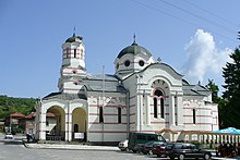
A church in Batak.
The province has considerable opportunities to develop mountain and rural tourism, especially in the southern parts where the Rhodope mountains are located. The slopes are covered with dense deciduous and higher up, coniferous forests, dotted with numerous artificial lakes. The largest one is the Batak Dam, on whose shores are built two resorts: Tsigov Chark and Saint Konstantin as well as many villas and shrines. Fish is abundant in the dams, including carp, rudd, roach barbel, perch, zander and many others; the mountain streams are rich in trout. There are spa resorts in Velingrad, Strelcha, Banya, Varvara. The most famous landmarks are located in Panagyurishte, Pazardzhik, Batak, Velingrad.
Impressive ruins of an ancient basilica (the Belovo Basilica) rise in the hilly country, close to the town of Belovo. Numerous ruined fortresses are scattered around the province, the most famous of these are Tsepina, and the ramparts near Bata and Strelcha. The medieval Church of St Demetrius in the village of Patalenitsa has frescoes dating to the 12th–13th century.
Transportation and communications
The road network is not dense. The Trakiya motorway runs through the middle of the region. The main railway between Sofia and Plovdiv also runs through it. There are two other railways: to Panagyurishte and to Peshtera. There are several military airports.
As everywhere in Bulgaria, every town and village in the region is provided with electricity, drinking water and telephone network. Each town and some villages are provided with Internet connection, and the cellular phone coverage is almost 100%, as most people own GSMs.
Some of the interconnecting roads, especially higher up the mountain, are currently in a very bad state following heavy downpours in 2005 and 2006.
See also
- Provinces of Bulgaria
- List of villages in Pazardzhik Province
Footnotes
^ ab (in Bulgarian) Population on 01.02.2011 by provinces, municipalities, settlements and age; National Statistical Institute
^ abcd (in English) "WorldCityPopulation"
^ abc "pop-stat.mashke.org"
^ abc Official site of the Pazardzhik Province
^ abc (in English) Bulgarian National Statistical Institute - Bulgarian provinces and municipalities in 2009
^ (in English) Bulgarian National Statistical Institute - Bulgarian towns in 2009
^ "pop-stat.mashke.org"
^ (in English) Bulgarian National Statistical Institute – Bulgarian villages under 1000 inhabitants – December 2009
^ (in English) [1]
^ (in Bulgarian) Population to 01.03.2001 by Area and Sex from Bulgarian National Statistical Institute: Census 2001
^ (in English) Bulgarian National Statistical Institute - Population by age in 2009 Archived 2012-05-13 at the Wayback Machine
^ Population by province, municipality, settlement and ethnic identification, by 01.02.2011; Bulgarian National Statistical Institute (in Bulgarian)
^ (in Bulgarian) Population to 01.03.2001 by District and Ethnic Group from Bulgarian National Statistical Institute: Census 2001
^ (in Bulgarian) Population to 01.03.2001 by District and Mother Tongue from Bulgarian National Statistical Institute: Census 2001
^ ""Religious composition: 2011 census"". pop-stat.mashke.org. Retrieved 29 June 2018..mw-parser-output cite.citationfont-style:inherit.mw-parser-output .citation qquotes:"""""""'""'".mw-parser-output .citation .cs1-lock-free abackground:url("//upload.wikimedia.org/wikipedia/commons/thumb/6/65/Lock-green.svg/9px-Lock-green.svg.png")no-repeat;background-position:right .1em center.mw-parser-output .citation .cs1-lock-limited a,.mw-parser-output .citation .cs1-lock-registration abackground:url("//upload.wikimedia.org/wikipedia/commons/thumb/d/d6/Lock-gray-alt-2.svg/9px-Lock-gray-alt-2.svg.png")no-repeat;background-position:right .1em center.mw-parser-output .citation .cs1-lock-subscription abackground:url("//upload.wikimedia.org/wikipedia/commons/thumb/a/aa/Lock-red-alt-2.svg/9px-Lock-red-alt-2.svg.png")no-repeat;background-position:right .1em center.mw-parser-output .cs1-subscription,.mw-parser-output .cs1-registrationcolor:#555.mw-parser-output .cs1-subscription span,.mw-parser-output .cs1-registration spanborder-bottom:1px dotted;cursor:help.mw-parser-output .cs1-ws-icon abackground:url("//upload.wikimedia.org/wikipedia/commons/thumb/4/4c/Wikisource-logo.svg/12px-Wikisource-logo.svg.png")no-repeat;background-position:right .1em center.mw-parser-output code.cs1-codecolor:inherit;background:inherit;border:inherit;padding:inherit.mw-parser-output .cs1-hidden-errordisplay:none;font-size:100%.mw-parser-output .cs1-visible-errorfont-size:100%.mw-parser-output .cs1-maintdisplay:none;color:#33aa33;margin-left:0.3em.mw-parser-output .cs1-subscription,.mw-parser-output .cs1-registration,.mw-parser-output .cs1-formatfont-size:95%.mw-parser-output .cs1-kern-left,.mw-parser-output .cs1-kern-wl-leftpadding-left:0.2em.mw-parser-output .cs1-kern-right,.mw-parser-output .cs1-kern-wl-rightpadding-right:0.2em
^ (in Bulgarian) Religious adherence in Bulgaria - census 2001
External links
- Official site of the Pazardzhik Province
Places adjacent to Pazardzhik Province | ||||||||||
|---|---|---|---|---|---|---|---|---|---|---|
| ||||||||||
Provinces of Bulgaria | |||
|---|---|---|---|
| |||
Etymological list of provinces of Bulgaria | |||
Bulgaria articles | |||||
|---|---|---|---|---|---|
| History |
|  | |||
| Geography |
| ||||
| Politics |
| ||||
| Economy |
| ||||
| Society |
| ||||
| |||||


