Kushki Kuhna District
Kushki Kuhna کشک کهنه | |
|---|---|
District | |
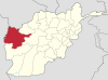
 Kushki Kuhna Location within Afghanistan | |
| Coordinates: 34°52′17″N 62°32′54″E / 34.8714°N 62.5483°E / 34.8714; 62.5483 | |
| Country | |
| Province | Herat Province |
| Population (2012)[1] | |
| • Total | 44,400 |
Kushki Kuhna is a district of Herat province in northwestern Afghanistan. It is situated in the northern part of the province. It borders Kushk District to the west, the nation of Turkmenistan to the north, Badghis Province to the east, and Karukh District to the south. The population Kushki Kuhna is 44,400 (as of 2012),[1] which includes the following ethnic groups: 55% Tajik, 40% Pashtun and 5% Hazara.[2]
The headquarters or district center is also known as Kushki Kuhna. The main source of income is the agriculture. The infrastructure, health and education systems have been improved since 2002.
Contents
1 Agriculture
2 References
3 External links
4 See also
Agriculture
The following table demonstrates the total amount of irrigated and rain-fed lands in the district.[3]
| Total (Jerib) | Irrigated (Jerib) | Rainfed (Jerib) | Forest (Hectare) |
|---|---|---|---|
| 20,000 | 2,000 | 18,000 | 100,000 |
References
^ ab "Settled Population of Herat Province" (PDF). Central Statistics Organization. Retrieved 26 January 2016..mw-parser-output cite.citationfont-style:inherit.mw-parser-output .citation qquotes:"""""""'""'".mw-parser-output .citation .cs1-lock-free abackground:url("//upload.wikimedia.org/wikipedia/commons/thumb/6/65/Lock-green.svg/9px-Lock-green.svg.png")no-repeat;background-position:right .1em center.mw-parser-output .citation .cs1-lock-limited a,.mw-parser-output .citation .cs1-lock-registration abackground:url("//upload.wikimedia.org/wikipedia/commons/thumb/d/d6/Lock-gray-alt-2.svg/9px-Lock-gray-alt-2.svg.png")no-repeat;background-position:right .1em center.mw-parser-output .citation .cs1-lock-subscription abackground:url("//upload.wikimedia.org/wikipedia/commons/thumb/a/aa/Lock-red-alt-2.svg/9px-Lock-red-alt-2.svg.png")no-repeat;background-position:right .1em center.mw-parser-output .cs1-subscription,.mw-parser-output .cs1-registrationcolor:#555.mw-parser-output .cs1-subscription span,.mw-parser-output .cs1-registration spanborder-bottom:1px dotted;cursor:help.mw-parser-output .cs1-ws-icon abackground:url("//upload.wikimedia.org/wikipedia/commons/thumb/4/4c/Wikisource-logo.svg/12px-Wikisource-logo.svg.png")no-repeat;background-position:right .1em center.mw-parser-output code.cs1-codecolor:inherit;background:inherit;border:inherit;padding:inherit.mw-parser-output .cs1-hidden-errordisplay:none;font-size:100%.mw-parser-output .cs1-visible-errorfont-size:100%.mw-parser-output .cs1-maintdisplay:none;color:#33aa33;margin-left:0.3em.mw-parser-output .cs1-subscription,.mw-parser-output .cs1-registration,.mw-parser-output .cs1-formatfont-size:95%.mw-parser-output .cs1-kern-left,.mw-parser-output .cs1-kern-wl-leftpadding-left:0.2em.mw-parser-output .cs1-kern-right,.mw-parser-output .cs1-kern-wl-rightpadding-right:0.2em
^ AIMS (Afghanistan Information Management Services), UNHCR Sub-Office District Profile of Kushki Khuna
^ "Herat Provincial Profile" (PDF). Ministry of Rural Rehabilitation and Development. Retrieved 26 January 2016.
External links
Map of Settlements AIMS, May 2002
See also
- Districts of Afghanistan
| Capital |
|  |
|---|---|---|
| Districts |
| |
| Cities |
| |
| Landmarks |
| |
This Herat Province, Afghanistan location article is a stub. You can help Wikipedia by expanding it. |


