District Council of Mount Barker
Mount Barker District Council South Australia | |||||||||||||||
|---|---|---|---|---|---|---|---|---|---|---|---|---|---|---|---|
 | |||||||||||||||
| Coordinates | 35°03′50″S 138°51′29″E / 35.0638888889°S 138.858055556°E / -35.0638888889; 138.858055556Coordinates: 35°03′50″S 138°51′29″E / 35.0638888889°S 138.858055556°E / -35.0638888889; 138.858055556 | ||||||||||||||
| Population | 33,397 (2016 census)[1] | ||||||||||||||
| • Density | 56.129456.13/km2 (145.3745145.37/sq mi) | ||||||||||||||
| Established | 1853 | ||||||||||||||
| Area | 595 km2 (229.7 sq mi) | ||||||||||||||
| Mayor | Ann Ferguson [2] | ||||||||||||||
| Council seat | Mount Barker | ||||||||||||||
| Region | Adelaide Hills[3] | ||||||||||||||
| State electorate(s) | Kavel, Heysen | ||||||||||||||
| Federal Division(s) | Mayo | ||||||||||||||
| Website | Mount Barker District Council | ||||||||||||||
| |||||||||||||||
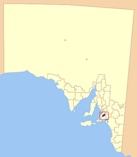
The Mount Barker District Council is a local government area centred on the town of Mount Barker just outside the Adelaide metropolitan area in South Australia.
The council was first established in October 1853.[4] It expanded to four times its original size on 21 March 1935 as part of a major series of council amalgamations, absorbing the District Council of Nairne and parts of the District Council of Echunga and the District Council of Macclesfield.[5]
Contents
1 Council
2 Towns and localities
3 See also
4 References
5 External links
Council
The current council as of June 2016 is:[6]
| Ward | Party[7] | Councillor | Notes | |
|---|---|---|---|---|
| Mayor | | Independent | Ann Ferguson | |
| South | | Independent | Greg Morrison | |
| | Independent | Roger Irvine | Deputy Mayor | |
| Central | | Independent | Carol Bailey | |
| | Independent | Lindsay Campbell | ||
| | Greens | Ian Grosser | ||
| | Independent | Trevor Keen | ||
| North | | Independent | Debs Buchmann | |
| | Liberal | Jeff Bettcher | ||
| | Independent | Harry Seager | ||
| | Liberal | Susan Hamilton | ||
Towns and localities
Towns and localities in the Mount Barker District Council include:[8]
- Biggs Flat
- Blakiston
Bradbury (part)
Bridgewater (part)- Brukunga
- Bugle Ranges
Bull Creek (part)
Callington (part)- Chapel Hill
- Dawesley
Dorset Vale (part)- Echunga
- Flaxley
- Green Hills Range
- Hahndorf
- Harrogate
Hay Valley (part)- Jupiter Creek
Kangarilla (part)- Kanmantoo
Kuitpo (part)- Littlehampton
Macclesfield (part)- Meadows
- Mount Barker
Mount Barker Junction (part)- Mount Barker Springs
- Mount Barker Summit
Mount Torrens (part)
Mylor (part)- Nairne
- Paechtown
Paris Creek (part)- Petwood
Prospect Hill (part)- St Ives
- Totness
Verdun (part)- Wistow
Woodside (part)
See also
- List of parks and gardens in rural South Australia
References
^ Australian Bureau of Statistics (27 June 2017). "Mount Barker (DC)". 2016 Census QuickStats. Retrieved 29 November 2017..mw-parser-output cite.citationfont-style:inherit.mw-parser-output .citation qquotes:"""""""'""'".mw-parser-output .citation .cs1-lock-free abackground:url("//upload.wikimedia.org/wikipedia/commons/thumb/6/65/Lock-green.svg/9px-Lock-green.svg.png")no-repeat;background-position:right .1em center.mw-parser-output .citation .cs1-lock-limited a,.mw-parser-output .citation .cs1-lock-registration abackground:url("//upload.wikimedia.org/wikipedia/commons/thumb/d/d6/Lock-gray-alt-2.svg/9px-Lock-gray-alt-2.svg.png")no-repeat;background-position:right .1em center.mw-parser-output .citation .cs1-lock-subscription abackground:url("//upload.wikimedia.org/wikipedia/commons/thumb/a/aa/Lock-red-alt-2.svg/9px-Lock-red-alt-2.svg.png")no-repeat;background-position:right .1em center.mw-parser-output .cs1-subscription,.mw-parser-output .cs1-registrationcolor:#555.mw-parser-output .cs1-subscription span,.mw-parser-output .cs1-registration spanborder-bottom:1px dotted;cursor:help.mw-parser-output .cs1-ws-icon abackground:url("//upload.wikimedia.org/wikipedia/commons/thumb/4/4c/Wikisource-logo.svg/12px-Wikisource-logo.svg.png")no-repeat;background-position:right .1em center.mw-parser-output code.cs1-codecolor:inherit;background:inherit;border:inherit;padding:inherit.mw-parser-output .cs1-hidden-errordisplay:none;font-size:100%.mw-parser-output .cs1-visible-errorfont-size:100%.mw-parser-output .cs1-maintdisplay:none;color:#33aa33;margin-left:0.3em.mw-parser-output .cs1-subscription,.mw-parser-output .cs1-registration,.mw-parser-output .cs1-formatfont-size:95%.mw-parser-output .cs1-kern-left,.mw-parser-output .cs1-kern-wl-leftpadding-left:0.2em.mw-parser-output .cs1-kern-right,.mw-parser-output .cs1-kern-wl-rightpadding-right:0.2em
^ "Mount Barker District Council". Local Government Association of South Australia. Retrieved 11 January 2016.
^ "Adelaide Hills SA Government region" (PDF). The Government of South Australia. Retrieved 10 October 2014.
^ "NEW DISTRICT COUNCILS". Adelaide Times. VII, (1003). South Australia. 24 October 1853. p. 2. Retrieved 9 April 2016 – via National Library of Australia.
^ Marsden, Susan (2012). "A History of South Australian Councils to 1936" (PDF). Local Government Association of South Australia. p. 6. Retrieved 30 October 2015.The District Council of Mount Barker was expanded to an area four times its previous size in 1935, including parts of Macclesfield and Echunga.
^ "Council Members". District Council of Mount Barker. Retrieved 6 June 2016.
^ "Council Members Register of Interests" (PDF). District Council of Mount Barker. Retrieved 6 June 2016.
^ "District Council of Mount Barker, Suburbs Localities". Local Government Association of South Australia. Retrieved 27 August 2015.
External links
- Local Government Association
- Official web site
This South Australia geography article is a stub. You can help Wikipedia by expanding it. |


