AH1
Asian Highway 1 | ||||
|---|---|---|---|---|
 | ||||
| Route information | ||||
| Length | 20,557 km (12,774 mi) | |||
| Major junctions | ||||
| East end | Tokyo, Japan | |||
| West end | Istanbul, Turkey | |||
| Location | ||||
| Countries | Tokyo, Japan via South Korea, North Korea, China, Southeast Asia, Bangladesh, India, Pakistan, Afghanistan and Iran to the border between Turkey and Bulgaria west of Istanbul where it joins end-on with European route E80 | |||
| Highway system | ||||
Asian Highway Network
| ||||

Asian Highway 1 (AH1) is the longest route of the Asian Highway Network, running 20,557 km (12,774 mi) from Tokyo, Japan via Korea, China, Southeast Asia, Bangladesh, India, Pakistan, Afghanistan and Iran to the border between Turkey and Bulgaria west of Istanbul where it joins end-on with European route E80.
Contents
1 Japan
2 South Korea
3 North Korea
4 China
5 Hong Kong
6 Vietnam
7 Cambodia
8 Thailand
9 Myanmar
10 India
11 Bangladesh
12 India
13 Pakistan
14 Afghanistan
15 Iran
16 Turkey
17 Connection to E80
18 References
Japan

AH1 at Nihonbashi, Tokyo, the "zero milepost" for measuring highway distances to Tokyo.
The 1200-kilometre[1] section in Japan was added to the system in November 2003.[2] It runs along the following tolled expressways:[3]
 Shuto Expressway C1 Inner Circular Route, Edobashi JCT to Tanimachi JCT via Takebashi JCT
 Shuto Expressway Route 3 Shibuya Line, Tanimachi JCT to Yoga Exit (Tokyo Interchange)
 Tōmei Expressway,[4] Tokyo Interchange to Komaki
- Meishin Expressway, Komaki to Suita via Kyoto
 Chūgoku Expressway, Suita to Kobe
 San'yō Expressway, Kobe to Hatsukaichi via Hiroshima
 Hiroshima Expressway (urban expressway), Hatsukaichi to Hatsukaichi Route 1
Japan National Route 2 Hatsukaichi to Iwakuni- San'yō Expressway, Iwakuni to Yamaguchi
- Chūgoku Expressway, Yamaguchi to Shimonoseki
- Kanmonkyo Bridge, Shimonoseki to Kitakyushu
 Kyushu Expressway, Kitakyushu to Fukuoka
 Fukuoka Expressway Route 4
- Fukuoka Expressway Route 1
![]() Camellia Line ferry to Busan, South Korea.
Camellia Line ferry to Busan, South Korea.
From Fukuoka, the Japan–Korea Undersea Tunnel has been proposed to provide a fixed crossing.
South Korea

The section in South Korea mainly follows the Gyeongbu Expressway. The Highway Boundary of South and North Korea.
 Busan Metropolitan Road 71: Busan-Centre - Busan-Dong-gu
 Busan Metropolitan Road 11: Busan-Dong-gu - Busan-Geumjeong-gu
 Gyeongbu Expressway: Busan-Geumjeong-gu - Gyeongju - Daegu - Daejeon - Seoul-Seocho-gu
 Seoul Metropolitan Road 41: Seoul-Seocho-gu - Seoul-Gangnam-gu - Seoul-Yongsan-gu
 Namsan 1st tunnel: Seoul-Yongsan-gu - Seoul-Jung-gu
 Seoul Metropolitan Road 21: Seoul-Jung-gu - Seoul-Eunpyeong-gu
 National Route 1: Seoul-Eunpyeong-gu - Panmunjeom
North Korea
P'anmunjǒm - Kaesǒng Pyongyang-Kaesong Motorway: Kaesǒng P'yǒngyang - Sinǔiju
- Pyongyang-Sinuiju Motorway (Under Construction): P'yǒngyang - Sinǔiju
China
 National Highway 304: Dandong
 G1113 Dandong-Fuxin Expressway: Dandong - Shenyang
 G1 Beijing-Harbin Expressway: Shenyang- Beijing
 G4 Beijing–Hong Kong–Macau Expressway: Beijing - Shijiazhuang - Zhengzhou - Xinyang - Wuhan - Changsha - Guangzhou
 G80 Guangzhou–Kunming Expressway: Guangzhou - Nanning
 G7211 Nanning–Youyiguan Expressway: Nanning - Youyiguan
Hong Kong
 Route 10: Shenzhen Bay Port - Shenzhen Bay Bridge - Lam Tei
 Route 9: Lam Tei - Yuen Long Highway - San Tin Highway - Huanggang Port
Vietnam
 : Hữu Nghị Quan - Đồng Đăng - Hanoi - Vinh - Đồng Hới - Đồng Hới - Đông Hà - Huế - Đà Nẵng - Hội An - Quy Nhơn - Nha Trang - Phan Thiết - Biên Hòa - Ho Chi Minh
 : Ho Chi Minh - Mộc Bài
Cambodia
 Route 1: Bavet - Phnom Penh
 Route 5: Phnom Penh - Poipet
Thailand
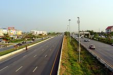
AH1, AH2 and Thailand Route 32 in Ayutthaya

Thai Myanmar Friendship Bridge
 Route 33: Aranyaprathet - Kabin Buri - Hin Kong
 Route 1: Hin Kong - Bang Pa In
 Route 32: - Bang Pa In - Chai Nat (Concurrent with
  )
)- Route 1: Chai Nat - Tak (Concurrent with )
 Route 12: Tak - Mae Sot
Myanmar
National Highway 8: Myawaddy - Payagyi
Branch Yangon–Mandalay Expressway : Payagyi - Yangon
Yangon–Mandalay Expressway: Payagyi - Meiktila - Mandalay
National Highway 7: (Concurrent with ): Mandalay - Tamu
India
 NH 102: Moreh - Imphal
 NH 2: Imphal - Kohima
 NH 29: Kohima - Dimapur - Doboka
 NH 27: Doboka - Nagaon - Jorabat
 NH 6: Jorabat - Shillong
 NH 206: Shillong - Dawki
Bangladesh

N2 in Bangladesh
 N2 Highway: Tamabil - Sylhet - Kanchpur - Dhaka
 N8 Highway: Dhaka - Mawa Ferry Terminal[5][6]
 Ferry Connection
- N8 Highway: Kaorakandi Ferry Terminal - Bhanga
Bhanga - Faridpur N7 Highway: Faridpur - Jessore
Jessore - Benapole[7]
India

Asean India car rally crossing AH1 at Numaligarh

Durgapur Expressway as part of AH1
 NH 112: Petrapole - Barasat
 NH 12: Barasat - Belgharia
Belghoria Expressway: Belgharia - Dankuni NH 19: Dankuni - Durgapur -Asansol - Dhanbad -Barhi-Prayagraj - Kanpur - Agra - New Delhi
 NH 44: New Delhi - Jalandhar
 NH 3: Jalandhar - Amritsar - Attari
Pakistan
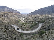
Khyber Pass

Motorway M2, Lahore-Islamabad
Wagah — Lahore Lahore — Islamabad
 Islamabad — Peshawar
 Peshawar — Torkham
Afghanistan
Afghanistan Ring Highway: Jalalabad - Kabul - Kandahar - Delaram - Herat - Islam Qala
Iran
 : Islam Qala - Taybad
 : Taybad- Sang Bast
 : Sang Bast - Shahrood - Damghan - Semnan - Tehran
 : Tehran - Qazvin - Tabriz
 : Tabriz - Bazargan
Turkey

Yavuz Sultan Selim Bridge
 Road D100: Gürbulak - Doğubayazıt - Aşkale - Refahiye
 Road D200: Refahiye - Sivas - Ankara
 Otoyol 4: Ankara - Gerede - İstanbul
 Otoyol 2: İstanbul
 Otoyol 3: İstanbul - Edirne - - Kapıkule (
 Bulgaria,
  Maritsa motorway)
Connection to E80

E80 across southern Europe and Turkey
The route AH1 is also marked as ![]() in Turkey. The E80 continues in the E-road network from the border station at Kapitan Andreevo/Kapıkule to Sofia in Bulgaria, followed by E80 highways to Niš, Pristina, Dubrovnik, Pescara, Rome, Genoa, Nice, Toulouse, Burgos, Valladolid, Salamanca and finally Lisbon on the Atlantic Ocean.
in Turkey. The E80 continues in the E-road network from the border station at Kapitan Andreevo/Kapıkule to Sofia in Bulgaria, followed by E80 highways to Niš, Pristina, Dubrovnik, Pescara, Rome, Genoa, Nice, Toulouse, Burgos, Valladolid, Salamanca and finally Lisbon on the Atlantic Ocean.
References
| Wikimedia Commons has media related to AH1. |
^ Economic and Social Commission for Asia and the Pacific, 2003 Asian Highway Handbook Archived 2012-04-14 at the Wayback Machine, 2003, page 54
^ Economic and Social Commission for Asia and the Pacific, 2003 Asian Highway Handbook Archived 2012-04-14 at the Wayback Machine, 2003, page 3
^ アジアハイウェイ標識の設置場所 (in Japanese). MLIT. Retrieved December 5, 2011..mw-parser-output cite.citationfont-style:inherit.mw-parser-output .citation qquotes:"""""""'""'".mw-parser-output .citation .cs1-lock-free abackground:url("//upload.wikimedia.org/wikipedia/commons/thumb/6/65/Lock-green.svg/9px-Lock-green.svg.png")no-repeat;background-position:right .1em center.mw-parser-output .citation .cs1-lock-limited a,.mw-parser-output .citation .cs1-lock-registration abackground:url("//upload.wikimedia.org/wikipedia/commons/thumb/d/d6/Lock-gray-alt-2.svg/9px-Lock-gray-alt-2.svg.png")no-repeat;background-position:right .1em center.mw-parser-output .citation .cs1-lock-subscription abackground:url("//upload.wikimedia.org/wikipedia/commons/thumb/a/aa/Lock-red-alt-2.svg/9px-Lock-red-alt-2.svg.png")no-repeat;background-position:right .1em center.mw-parser-output .cs1-subscription,.mw-parser-output .cs1-registrationcolor:#555.mw-parser-output .cs1-subscription span,.mw-parser-output .cs1-registration spanborder-bottom:1px dotted;cursor:help.mw-parser-output .cs1-ws-icon abackground:url("//upload.wikimedia.org/wikipedia/commons/thumb/4/4c/Wikisource-logo.svg/12px-Wikisource-logo.svg.png")no-repeat;background-position:right .1em center.mw-parser-output code.cs1-codecolor:inherit;background:inherit;border:inherit;padding:inherit.mw-parser-output .cs1-hidden-errordisplay:none;font-size:100%.mw-parser-output .cs1-visible-errorfont-size:100%.mw-parser-output .cs1-maintdisplay:none;color:#33aa33;margin-left:0.3em.mw-parser-output .cs1-subscription,.mw-parser-output .cs1-registration,.mw-parser-output .cs1-formatfont-size:95%.mw-parser-output .cs1-kern-left,.mw-parser-output .cs1-kern-wl-leftpadding-left:0.2em.mw-parser-output .cs1-kern-right,.mw-parser-output .cs1-kern-wl-rightpadding-right:0.2em
^ Economic and Social Commission for Asia and the Pacific,2003 Asian Highway Handbook Archived 2012-04-14 at the Wayback Machine, 2003, page 54 shows an aerial photo of the Yokohama Aoba Interchange, placing AH1 clearly on the Tomei Expressway rather than the other Tokyo-Nagoya expressway, the Chūō Expressway.
^ Regional Road Connectivity Bangladesh Perspective(PDF). RHD. Retrieved February 19, 2017.
^ "Asian Highway Route Map" (PDF). ESCAP. Retrieved February 19, 2017.
^ http://www.rhd.gov.bd/RHDMaps/Maps/Country_Bangladesh.pdf
Asian Highway Network | ||
|---|---|---|
| Across the whole continent |
|  |
| Southeast Asia |
| |
| East Asia, Northeast Asia and Southeast Asia |
| |
| South Asia |
| |
| North Asia, Central Asia and Southwest Asia |
| |


