Šabac
Šabac Град Шабац | |||
|---|---|---|---|
| City | |||
| City of Šabac | |||
     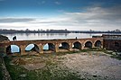  Photomontage of Šabac | |||
| |||
 Location of the city of Šabac within Serbia | |||
| Coordinates: 44°45′N 19°42′E / 44.750°N 19.700°E / 44.750; 19.700Coordinates: 44°45′N 19°42′E / 44.750°N 19.700°E / 44.750; 19.700 | |||
| Country | |||
| Region | Šumadija and Western Serbia | ||
| District | Mačva | ||
| Settlements | 52 | ||
| Government | |||
| • Mayor | Nebojša Zelenović | ||
| Area[1] | |||
| Area rank | 25th in Serbia | ||
| • Urban | 30.89 km2 (11.93 sq mi) | ||
| • Administrative | 795 km2 (307 sq mi) | ||
| Elevation | 83 m (272 ft) | ||
| Population (2011 census)[2] | |||
| • Rank | 11th in Serbia | ||
| • Urban | 53,919 | ||
| • Urban density | 1,700/km2 (4,500/sq mi) | ||
| • Administrative | 118,347 | ||
| • Administrative density | 150/km2 (390/sq mi) | ||
| Time zone | UTC+1 (CET) | ||
| • Summer (DST) | UTC+2 (CEST) | ||
| Postal code | 15000 | ||
| Area code | +381(0)15 | ||
| Car plates | ŠA | ||
| Climate | Cfb | ||
| Website | www.sabac.org | ||


Serbian Orthodox church, Central Šabac

Šabac, Kingdom of Serbia, 1904

Šabac library

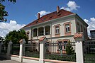
Hotel in Šabac
Šabac (Serbian Cyrillic: Шабац, pronounced [ʃâbat͡s]) is a city located in the Mačva region of western Serbia. It is situated on the banks of the Sava river near the Cer mountain. As of 2011, it has a population of 118,347 inhabitants.
Contents
1 Name
2 History
3 Demographics
3.1 Ethnic groups
4 Local communities
4.1 Urban local communities
4.2 Rural local communities
5 Economy
6 Sport
7 Local media
7.1 Radio stations
7.2 TV stations
7.3 Newspapers
8 Education
8.1 Elementary schools
8.2 High schools
8.3 Private centres of education
8.4 Teachers' associations
9 Transportation
9.1 Roads
9.2 Railway
10 Politics
11 Non-government organizations in Šabac
12 Trade Unions
13 Notable people
14 Coat of arms of Šabac and armorial flag
15 Twin cities
16 References
16.1 Footnotes
17 External links
Name
The etymology of name Šabac is uncertain, although its resemblance to the name of the Sava River is suggestive. This name is in use since the end of the 15th century. In Serbian, the town is known as Šabac (Шабац), in Bosnian as Šabac, in Turkish as Böğürdelen, in German as Schabatz, and in Hungarian as Szabács.
History
Human settlements existed in this area in neolithic times.[3] In the Middle Ages, Slavic settlement named Zaslon existed at the current location of Šabac.[3] This settlement was mentioned in Ragusan documents from 1454. The settlement was part of the Serbian Despotate until it fell to the Ottoman Empire in 1459.
In 1470, the Ottomans built the first fortress in the town and named it Bejerdelen (Böğürdelen, meaning "side-striker"). In 1476 the Hungarian king Matthias captured the fort and it stayed under administration of the Kingdom of Hungary until 1521, when it was again captured by the Ottomans. Under Hungarian administration, the town was part of the Banovina of Mačva whereas under Ottoman administration it was firstly part of the Sanjak of Zvornik within the Province of Bosnia, and later part of the Sanjak of Smederevo. Šabac was the administrative center of the Nahija of Šabac, a local Ottoman administrative unit. During the Ottoman period, Šabac was a typical oriental town with tiny streets, small shops and several mosques. Population was composed of both, Muslims and Serbs.[3]
Until the 19th century, Šabac was mostly under Ottoman administration, but control of the town also changed hands several times between the Ottoman Empire and Habsburg Monarchy. During the first period of Habsburg administration (1718-1739), Šabac was part of the Habsburg Kingdom of Serbia. After the Treaty of Belgrade (1739), Šabac reverted to Ottoman control and, with the new border line between the two empires, it gained importance as a border town, as well as a market town. A second period of Habsburg control of the area occurred in 1789-1790, the storming of the city being one of the early experiences of the renowned military leader Józef Poniatowski, but the Ottoman control over area was subsequently restored.
Šabac became a site of importance in Serbian history in the First Serbian Uprising when, in 1806, Karađorđe Petrović led the Serbian insurgents into one of the first victories over the Ottoman army near the nearby village of Mišar. Until 1813, the town was part of Karađorđe's Serbia. After the fall of Serbia in 1813, brief period of restored Ottoman control followed, but after the Second Serbian Uprising in 1815, Šabac was included into autonomous Principality of Serbia. However, Ottoman army remained in the Šabac fort for next several decades. The Obrenović family also left a mark on the town as the place of residence of the enlightened Jevrem Obrenović, brother of Prince Miloš Obrenović, who modernized and urbanized it after the Second Serbian Uprising. The period from 1820-1850 saw the establishment for the first time in Šabac of a hospital, a pharmacy, a Serbian grammar school, a gymnasium, a theatre, and a musical society.
The Ottoman army evacuated the fort of Šabac for good in 1867, marking the end of the Ottoman presence in the area. The first newspaper in the Kingdom of Serbia was printed in Šabac in 1883, and the town was also the first in Serbia where women started visiting kafanas (pubs) on Sunday afternoons, as was customary for men.
The town prospered until the First World War when it was occupied and devastated by Austro-Hungarian army and had its population halved (from cca. 14,000 to 7,000). The World War I is also remembered for the battle on nearby Cer mountain where the Serbian army under general Stepa Stepanović won an early victory against Austria-Hungary in August 1914, the first Allied victory in the war.[citation needed] After the war, Šabac was decorated with French War Cross with Palm (1920), Czechoslovak War Cross (1925), and the Order of the Karađorđe's Star with Swords (1934).
Since 1918, the town is part of the newly formed Kingdom of Serbs, Croats and Slovenes (later renamed to Yugoslavia). From 1918 to 1922, it was administrative seat of Podrinje District, from 1922 to 1929 administrative seat of Podrinje Oblast, and from 1929 to 1941 it was part of the Drina Banovina. An early milestone in the Yugoslav era of the town's history was the opening of the Zorka chemical plant in 1938. The city's renewal was interrupted by World War II and occupation by German troops (from 1941–44). During the German occupation, Šabac was part of the area governed by the Military Administration in Serbia. Some 5,000 residents of Šabac were imprisoned along with 20,000 others in the Šabac concentration camp; including 1,200 fleeing Jews in the ill-fated Kladovo transport.[4]
Eventually, 7,000 inmates were killed.[clarification needed] The city was liberated from occupation by the Yugoslav Partisans in 1944. After the war, it was included into People's Republic of Serbia within new socialist Yugoslavia. Since then, it grew into a modern industrial city with the aforementioned Zorka chemical plant and the expanded population. The 1970s saw the construction of the first modern sports hall. The swamp at the city's outskirts, Benska Bara, was drained and turned into a residential neighborhood, and a new bridge was built over the Sava river. By 2010, the population of the city and its suburbs had risen to 75,000.
Demographics
| Historical population | ||
|---|---|---|
| Year | Pop. | ±% p.a. |
| 1948 | 75,096 | — |
| 1953 | 82,414 | +1.88% |
| 1961 | 94,866 | +1.77% |
| 1971 | 107,143 | +1.22% |
| 1981 | 119,669 | +1.11% |
| 1991 | 123,633 | +0.33% |
| 2002 | 122,893 | −0.05% |
| 2011 | 115,884 | −0.65% |
| Source: [5] | ||
According to the 2011 census results, the city of Šabac has a population of 115,884 inhabitants.
Ethnic groups
The ethnic composition of the city of Šabac:
| Ethnic group | Population |
|---|---|
| Serbs | 110,642 |
| Roma | 1,902 |
| Muslims | 393 |
| Croats | 165 |
| Yugoslavs | 123 |
| Others | 2,659 |
| Total | 115,884 |
Local communities
Urban local communities
|
|
|
Rural local communities

Map of the city of Šabac
|
|
|
Economy
Prior to 1990, Šabac had one of the best developed economies in Yugoslavia. International sanctions against Yugoslavia during Bosnian War provoked the shutdown of the Zorka plant, which was the main enterprise in Šabac. Many other major local firms like "Šapčanka", "Izgradnja", and "Nama" also shut down during this period. The main industries of Šabac today are agriculture, transportation and food production. Since 2000, some of the more important companies are diary plant Mlekara Šabac, Elixir Group, Zorka Pharma, and Hesteel Serbia Iron & Steel - Tin mill.
The following table gives a preview of total number of employed people per their core activity (as of 2016):[6]
| Activity | Total |
|---|---|
| Agriculture, forestry and fishing | 248 |
| Mining | 65 |
| Processing industry | 6,168 |
| Distribution of power, gas and water | 361 |
| Distribution of water and water waste management | 447 |
| Construction | 1,484 |
| Wholesale and retail, repair | 5,776 |
| Traffic, storage and communication | 1,690 |
| Hotels and restaurants | 699 |
| Media and telecommunications | 342 |
| Finance and insurance | 574 |
| Property stock and charter | 67 |
| Professional, scientific, innovative and technical activities | 882 |
| Administrative and other services | 628 |
| Administration and social assurance | 1,489 |
| Education | 2,167 |
| Healthcare and social work | 2,11 |
| Art, leisure and recreation | 354 |
| Other services | 588 |
| Total | 26,148 |
Sport
There are several sports societies in Šabac:
- Kayak club "Zorka color" Šabac
- FK Mačva Šabac
- RK Metaloplastika
- Basketball club Šabac
- Waterpoolo club Šabac
- Boxing club Šabac
- Female handball club Medicinar
Local media
|
|
|
Education

Šabac Grammar School

Street in Šabac
Elementary schools
This is a list of elementary schools in Šabac.
- OŠ "Sele Jovanović"
- OŠ "Nikolaj Velimirović" (official web site)
- OŠ "Vuk Karadzić"
- OŠ "Stojan Novaković"
- OŠ "Nata Jeličić"
- OŠ "Janko Veselinović"
- OŠ "Laza Lazarević"
High schools
This is a list of high schools in Šabac.
- Šabačka gimnazija (Šabac Grammar School)
- High agriculture school
- High medicine school "Dr Andra Jovanović"
- High economical-commercial school
- High chemical and textile school
- High technical school
- High music school Mihailo Vukdragović
- High art school
Private centres of education
- King's College[7]
- Premier
- Pygmalion[8]
- Interlink
Teachers' associations
Several teachers' associations exist in Šabac.
- English Language Teachers` Association, Macva county
Transportation
Roads
The length and status of roads in the city are:
- Main roads 59.9 km (37.2 mi) (all asphalt)
- Regional roads 111.4 km (69.2 mi) (all asphalt)
- Local roads 304.2 km (189.0 mi) (187.8 km (116.7 mi) asphalt)
- Unconventional roads 2,700 km (1,678 mi) (only 20 km (12 mi) asphalt)
- City streets 10 km (6 mi)

Serbian Railways class 711 diesel multiple unit on Šabac-Ruma local passenger train leaving Šabac.
Railway
The railroad through Šabac connects Ruma (corridor X) and across Šabac, Loznica and Zvornik proceed Drina and connect Serbia with Bosnia and Herzegovina. A branch which connected this line with Bogatić (Petlovača - Bogatić) is locked out. The railway is used for the transport of goods and raw materials for the Zorka factory and passenger transport to Ruma.
Politics
Seats in the city parliament won in the 2004 local elections: [1]
Democratic Party - Serbian Renewal Movement (25)
Serbian Radical Party (13)
Democratic Party of Serbia (11)
Socialist Party of Serbia (8)
Strength of Serbia Movement (6)
G17 Plus (4)
People's Peasant Party (2)- Group of the citizens "The voice of the people" (2)
Non-government organizations in Šabac
According to unofficial data, in the city of Šabac, there are over 300 registered non-government organizations, with wide variety of activities and different primary goals. Traditionally, the most active are those organizations whose primary goals are humanitarian, protection of the rights of persons with disabilities, protection of the rights of ethnic minorities, protection of the vulnerable social categories, ecology, etc.
Beside traditionally active organizations in Šabac, there are non-government organizations which unites young people in purpose of protecting their own rights. Under the social category of youth (young people) are those who are not older than 30, and not younger than 15 years, according to Ministry (Department) of youth and sports, of the Republic of Serbia.
Some of the most active organizations in Šabac are: Youth Umbrella (Omladinski Kišobran), Caritas - Šabac, Roma for Roma, Human heart of Šabac (Humano srce Šapca), NGO Light, NGO Ecos.
Trade Unions
- Sindikat OŠ "Sele Jovanović"
Notable people

Vladimir Jovanović
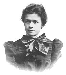
Mileva Marić - Einstein

Józef Poniatowski
Antun Gustav Matoš, writer
Branimir Ćosić, writer and journalist
Branislav Lečić, actor
Draga Ljočić, the first female doctor in Serbia
Dragiša Lapčević, politician, journalist, historian
Isidora Sekulić, writer
Janko Veselinović, writer
Jela Spiridonović-Savić, poet
Jevrem Obrenović, younger brother of Prince Miloš Obrenović, governor of the Šabac nahija (district)
Jovan Cvijić, geographer, president of the Serbian Royal Academy, rector of the Belgrade University
Józef Poniatowski, Polish leader, general
Kosta Abrašević, poet
Laza Lazarević, doctor, writer
Ljubiša Jovanović, actor
Mileva Marić, Serbian physicist
Milić Stanković, painter
Milorad Popović Šapčanin, poet, writer, dramatist, pedagogue and educational reformer
Sasha Knezev, Serbian American filmmaker and author
Slobodan Jovanović, historian, lawyer, literary critic and politician
Stanislav Vinaver, avant-garde writer
Stojan Novaković, historian, scholar, writer, literary critic, translator, politician and diplomat
Šaban Šaulić, folk singer
Veselin Vujović, handball player
Vladimir Jovanović, philosopher, political theorist, economist, politician, political writer
Vladislav Lalicki, production designer, costume designer, painter
Živojin Pavlović, film director, writer
Jasmina Vujic, nuclear engineering professor at Berkeley, 1st female nuclear engineering department chair in the US
Sportspeople:
Mile Isaković, handballer
Milutin Dragićević, handballer
Miroslav Đukić, footballer
Nemanja Matić, footballer
Coat of arms of Šabac and armorial flag
There are three versions of the coat of arms of Šabac: the Primary, Middle, and Large.

Primary coat of arms

Middle coat of arms
Šabac Armorial flag


Twin cities
Šabac is twinned with the following cities:
 Argostoli
 Fujimi[9]
 Kiryat Atta
 Kralupy nad Vltavou
References
Footnotes
^ "Municipalities of Serbia, 2006". Statistical Office of Serbia. Retrieved 2010-11-28..mw-parser-output cite.citationfont-style:inherit.mw-parser-output qquotes:"""""""'""'".mw-parser-output code.cs1-codecolor:inherit;background:inherit;border:inherit;padding:inherit.mw-parser-output .cs1-lock-free abackground:url("//upload.wikimedia.org/wikipedia/commons/thumb/6/65/Lock-green.svg/9px-Lock-green.svg.png")no-repeat;background-position:right .1em center.mw-parser-output .cs1-lock-limited a,.mw-parser-output .cs1-lock-registration abackground:url("//upload.wikimedia.org/wikipedia/commons/thumb/d/d6/Lock-gray-alt-2.svg/9px-Lock-gray-alt-2.svg.png")no-repeat;background-position:right .1em center.mw-parser-output .cs1-lock-subscription abackground:url("//upload.wikimedia.org/wikipedia/commons/thumb/a/aa/Lock-red-alt-2.svg/9px-Lock-red-alt-2.svg.png")no-repeat;background-position:right .1em center.mw-parser-output .cs1-subscription,.mw-parser-output .cs1-registrationcolor:#555.mw-parser-output .cs1-subscription span,.mw-parser-output .cs1-registration spanborder-bottom:1px dotted;cursor:help.mw-parser-output .cs1-hidden-errordisplay:none;font-size:100%.mw-parser-output .cs1-visible-errorfont-size:100%.mw-parser-output .cs1-subscription,.mw-parser-output .cs1-registration,.mw-parser-output .cs1-formatfont-size:95%.mw-parser-output .cs1-kern-left,.mw-parser-output .cs1-kern-wl-leftpadding-left:0.2em.mw-parser-output .cs1-kern-right,.mw-parser-output .cs1-kern-wl-rightpadding-right:0.2em
^ "2011 Census of Population, Households and Dwellings in the Republic of Serbia: Comparative Overview of the Number of Population in 1948, 1953, 1961, 1971, 1981, 1991, 2002 and 2011, Data by settlements" (PDF). Statistical Office of Republic Of Serbia, Belgrade. 2014. ISBN 978-86-6161-109-4. Retrieved 2014-06-27.
^ abc "Zvanična prezentacija grada Šapca - Istorija".
^ Anderl and Manoschek. 2001 Gescheitert Flucht. Vienna: Mandelbaum.
^ "2011 Census of Population, Households and Dwellings in the Republic of Serbia" (PDF). stat.gov.rs. Statistical Office of the Republic of Serbia. Retrieved 11 January 2017.
^ "ОПШТИНЕ И РЕГИОНИ У РЕПУБЛИЦИ СРБИЈИ, 2017" (PDF). stat.gov.rs (in Serbian). Statistical Office of the Republic of Serbia. Retrieved 8 December 2017.
^ http://www.kingscollege.rs/ Archived July 17, 2009, at the Wayback Machine.
^ "Pygmalion School of English".
^ "List of Affiliation Partners within Saitama Prefecture". International Exchange. Archived from the original on 2016-01-04.
External links
- City of Šabac official web site
- Šabac Summer Festival web site
| Wikimedia Commons has media related to Šabac. |
Municipalities and cities of Serbia | ||||||||||||
|---|---|---|---|---|---|---|---|---|---|---|---|---|
| ||||||||||||
| ||||||||||||
| ||||||||||||
| ||||||||||||
| ||||||||||||


